
1958 Map of Phenix City
USGS Topo · Published 1958About this map
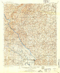
Chattahoochee River waters define the heart of this mid-century landscape, separating Phenix City in Alabama from the industrial and military hub of Columbus in Georgia. This 1958 survey captures the region during a period of significant military presence, dominated by the expansive Fort Benning Military Reservation and the recreational grounds of Franklin D Roosevelt State Park. To the west, the academic and industrial centers of Auburn and Opelika are clearly detailed alongside the reservoir of Martin Lake.
Find a feature on this map
48 named features on this map. Tap any name to fly to it.
Don’t see what you’re looking for? This feature index may not catch every label — zoom into the map to look around manually.
Map Details
Editions of this 1958 Phenix City Map
This is the sole edition of this map. No revisions or reprints were ever made.
Other maps of this area

1890 · Talladega
USGS Topo · 1:125,000

1891 · Ashland
USGS Topo · 1:125,000

1892 · Talladega
USGS Topo · 1:125,000

1899 · Wedowee
USGS Topo · 1:125,000

1901 · Wetumpka
USGS Topo · 1:125,000
1901 · Wetumpka
USGS Topo · 1:62,500

1902 · Wedowee
USGS Topo · 1:125,000

1903 · Wetumpka
USGS Topo · 1:125,000

1906 · Dadeville
USGS Topo · 1:125,000
1907 · Talbotton
USGS Topo · 1:125,000