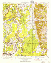
1932 Map of Philipp
USGS Topo · Published 1955About this map
The Tallahatchie River and Yalobusha River define this lowland landscape, where a complex network of bayous and oxbow lakes like Hampton Lake and Fish Lake mark the alluvial plain. In the early 1930s, this region was a tapestry of small rural communities and church-centered settlements such as Locopolis, Philipp, and Tippo. The presence of the Columbus and Greenville RR and the Beat Line Road provided essential transportation links through the bottomlands. Education and faith were central to local life, evidenced by numerous institutions including Rosenwald Sch, St Mark Ch, and Cypress Grove Chapel. To the east, the terrain rises toward Stonefield Hill and Rattlesnake Hill, offering a sharp contrast to the marshy western basins protected by a winding Levee system. This survey preserves a detailed view of the rural South before major mid-century agricultural shifts changed the settlement patterns.
Find a feature on this map
89 named features on this map. Tap any name to fly to it.
Don’t see what you’re looking for? This feature index may not catch every label — zoom into the map to look around manually.
Map Details
Editions of this 1932 Philipp Map
4 editions found
Other maps of this area

1931 · Schlater
USGS Topo · 1:48,000

1931 · Sumner
USGS Topo · 1:48,000

1932 · Philipp
USGS Topo · 1:48,000

1932 · Tutwiler
USGS Topo · 1:48,000

1934 · Schlater
USGS Topo · 1:62,500

1935 · Crowder
USGS Topo · 1:62,500

1935 · Sumner
USGS Topo · 1:62,500

1935 · Tutwiler
USGS Topo · 1:62,500

1935 · Philipp
USGS Topo · 1:62,500

1936 · Greenwood
USGS Topo · 1:62,500