
1935 Map of Philipp
USGS Topo · Published 1935About this map
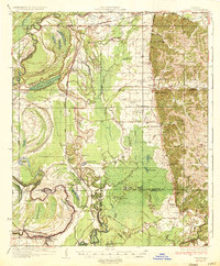
Tallahatchie River bottomlands dominate this mid-1930s landscape, where a complex network of bayous and oxbow lakes like Hampton Lake and Fish Lake reveal the shifting hydrology of the Delta. The Yazoo and Mississippi Valley Railroad provides a straight north-south spine through the alluvial plain, connecting settlements such as Locopolis and Philipp. This era shows a densely settled rural society organized around small community hubs, evidenced by numerous schools and churches including the Rosenwald Sch and St Mark Ch.
Find a feature on this map
103 named features on this map. Tap any name to fly to it.
Don’t see what you’re looking for? This feature index may not catch every label — zoom into the map to look around manually.
Map Details
Editions of this 1935 Philipp Map
2 editions found
Other maps of this area

1931 · Schlater
USGS Topo · 1:48,000

1931 · Sumner
USGS Topo · 1:48,000

1932 · Philipp
USGS Topo · 1:48,000

1932 · Tutwiler
USGS Topo · 1:48,000

1934 · Schlater
USGS Topo · 1:62,500

1935 · Crowder
USGS Topo · 1:62,500

1935 · Sumner
USGS Topo · 1:62,500

1935 · Tutwiler
USGS Topo · 1:62,500

1936 · Greenwood
USGS Topo · 1:62,500

1939 · Schlater
USGS Topo · 1:62,500