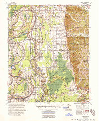
1957 Map of Philipp
USGS Topo · Published 1957About this map
Philipp and the surrounding Yazoo-Mississippi Delta lowlands appear here in the mid-1950s, defined by an intricate network of waterways and flood control measures. The Tallahatchie River meanders through the landscape alongside engineering projects like the Tillatoba Cut-Off 1940 and Possum Bayou Cut-Off 1940, which transformed the natural drainage of the region. The map reveals a dense settlement pattern of small communities such as Effie, Tippo, and Leverett, many of which were centers of rural life organized around localized churches and schools.
Find a feature on this map
115 named features on this map. Tap any name to fly to it.
Don’t see what you’re looking for? This feature index may not catch every label — zoom into the map to look around manually.
Map Details
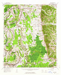
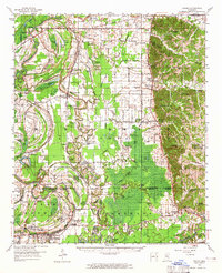
Editions of this 1957 Philipp Map
3 editions found
Other maps of this area

1931 · Schlater
USGS Topo · 1:48,000

1931 · Sumner
USGS Topo · 1:48,000

1932 · Philipp
USGS Topo · 1:48,000

1932 · Tutwiler
USGS Topo · 1:48,000

1934 · Schlater
USGS Topo · 1:62,500

1935 · Crowder
USGS Topo · 1:62,500

1935 · Sumner
USGS Topo · 1:62,500

1935 · Tutwiler
USGS Topo · 1:62,500

1935 · Philipp
USGS Topo · 1:62,500

1936 · Greenwood
USGS Topo · 1:62,500