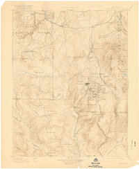
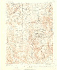
1901 Map of Pikes Peak
USGS Topo · Published 1919About this map
Cripple Creek serves as the industrial and social heart of this 1890s survey, surrounded by a dense network of mining towns including Victor, Goldfield, and Elkton. The geography reflects the height of the Colorado gold rush, with the Colorado Midland Railroad snaking through the northern peaks from Lake George to Divide, providing essential transit for the region's mineral wealth. To the south, the landscape transitions from the busy mining districts into the expansive grazing lands of Eightmile Park and Shaws Park. Notable landmarks like the Fossil Beds near Florissant and the high summit of Pikes Peak anchor the diverse terrain. The intricate labeling of smaller settlements such as Marigold, Wilbur, and Adelaide highlights the transient but significant communities that formed during this period of intensive mountain development.
Find a feature on this map
118 named features on this map. Tap any name to fly to it.
Don’t see what you’re looking for? This feature index may not catch every label — zoom into the map to look around manually.
Map Details
Editions of this 1901 Pikes Peak Map
6 editions found

Other maps of this area

1889 · Canon City
USGS Topo · 1:125,000

1891 · Pueblo
USGS Topo · 1:125,000

1892 · Canon City
USGS Topo · 1:125,000

1893 · Platte Canyon
USGS Topo · 1:125,000

1893 · Colorado Springs
USGS Topo · 1:125,000

1894 · Pikes Peak
USGS Topo · 1:125,000

1894 · Castle Rock
USGS Topo · 1:125,000

1894 · Pueblo
USGS Topo · 1:125,000

1896 · Pueblo
USGS Topo · 1:125,000

1897 · Pueblo
USGS Topo · 1:125,000