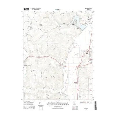
2016 Map of Piketon
USGS Topo · Published 2016About this map
The Scioto River valley dominates this portion of Pike County, where the village of Piketon sits across from the smaller settlement of Jasper. The map reveals a landscape defined by significant elevation changes, with numerous named peaks such as Combs Knob, Sponyers Knob, and Jasper Knob rising above the river bottomlands. This 2016 survey is particularly valuable for genealogists, as it documents a high density of rural burial grounds including Mound Cem, Rittenour Cem, Vine Chapel Cem, and Pleasant Valley Cem. The northern reach is characterized by the waters of Lake White, bordered by developed areas like Waverly Gables and Lake View Heights. To the south and west, the terrain becomes increasingly dissected by tributaries such as Sunfish Creek and Long Fork, leading toward Yankee Hill and the community of Bethel.
Find a feature on this map
114 named features on this map. Tap any name to fly to it.
Don’t see what you’re looking for? This feature index may not catch every label — zoom into the map to look around manually.
Map Details
Editions of this 2016 Piketon Map
This is the sole edition of this map. No revisions or reprints were ever made.
Other maps of this area

1906 · Waverly
USGS Topo · 1:62,500

1908 · Waverly
USGS Topo · 1:62,500

1911 · Sciotoville
USGS Topo · 1:62,500

1913 · Sciotoville
USGS Topo · 1:62,500

1915 · Otway
USGS Topo · 1:62,500

1915 · Piketon
USGS Topo · 1:62,500

1917 · Piketon
USGS Topo · 1:62,500

1917 · Otway
USGS Topo · 1:62,500

1944 · Piketon
USGS Topo · 1:62,500

1947 · Columbus
USGS Topo · 1:250,000