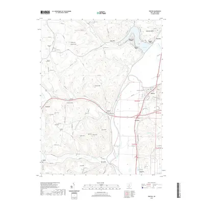
2019 Map of Piketon
USGS Topo · Published 2019About this map
Scioto River dominates the eastern half of this landscape, defining the valley where the historic settlements of Piketon and Waverly grew. The terrain transitions from the broad river bottomlands to the sharp, wooded ridges and knobs of the west, including Jasper Knob and Painters Knob. Lake White serves as a prominent landmark near Waverly Gables, surrounded by residential areas like Riviera Park and Lake View Heights. Family history is deeply etched into the topography here, with numerous small burial grounds such as Mound Cem, Rittenour Cem, and Pfeifer Cem scattered across the hills and townships. The map also records the rural infrastructure of Pike County, featuring a dense network of township and county roads connecting isolated locales like Yankee Hill and Tennyson.
Find a feature on this map
113 named features on this map. Tap any name to fly to it.
Don’t see what you’re looking for? This feature index may not catch every label — zoom into the map to look around manually.
Map Details
Editions of this 2019 Piketon Map
This is the sole edition of this map. No revisions or reprints were ever made.
Other maps of this area

1906 · Waverly
USGS Topo · 1:62,500

1908 · Waverly
USGS Topo · 1:62,500

1911 · Sciotoville
USGS Topo · 1:62,500

1913 · Sciotoville
USGS Topo · 1:62,500

1915 · Otway
USGS Topo · 1:62,500

1915 · Piketon
USGS Topo · 1:62,500

1917 · Piketon
USGS Topo · 1:62,500

1917 · Otway
USGS Topo · 1:62,500

1944 · Piketon
USGS Topo · 1:62,500

1947 · Columbus
USGS Topo · 1:250,000