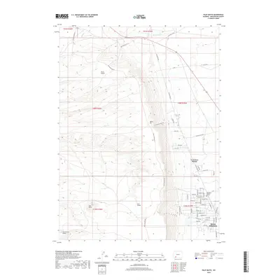
2018 Map of Pilot Butte
USGS Topo · Published 2018About this map
White Mtn dominates this portion of Sweetwater County, creating a massive high-elevation plateau that divides the landscape northwest of Rock Springs. The topography is defined by sharp erosion, where drainage systems like Skunk Canyon, Scott Canyon, and Greasewood Canyon cut deep into the mountain’s western flanks. While the rugged upper elevations remain largely undeveloped, the southern and eastern edges of the map show the encroaching residential expansion of North Rock Springs. This growth is evidenced by a dense network of suburban streets such as Lakota Dr and Fairview Ln, which terminate abruptly against the rising slopes of the mountain. Farther north, the land remains dominated by open range and ranching access, with routes like Stassinos Ranch Rd and Chiltons Cutoff traversing the high desert. To the southwest, the distinctive landmark of Pilot Butte stands as a prominent volcanic remnant overlooking the surrounding plains.
Find a feature on this map
61 named features on this map. Tap any name to fly to it.
Don’t see what you’re looking for? This feature index may not catch every label — zoom into the map to look around manually.
Map Details
Editions of this 2018 Pilot Butte Map
This is the sole edition of this map. No revisions or reprints were ever made.
Other maps of this area

1908 · Rock Springs
USGS Topo · 1:62,500

1910 · Rock Springs
USGS Topo · 1:62,500

1954 · Rock Springs
USGS Topo · 1:250,000

1958 · Rock Springs
USGS Topo · 1:250,000

1958 · Boars Tusk
USGS Topo · 1:62,500

1961 · Scott Spring
USGS Topo · 1:24,000

1961 · Pilot Butte
USGS Topo · 1:24,000

1961 · Kanda
USGS Topo · 1:24,000

1961 · Green River
USGS Topo · 1:24,000

1962 · Rock Springs
USGS Topo · 1:250,000