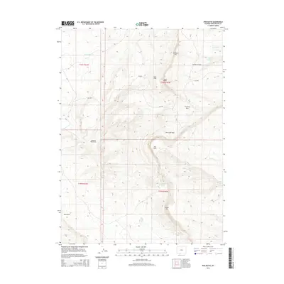
2015 Map of Pine Butte
USGS Topo · Published 2015About this map
Pine Butte and its namesake basin dominate this high-altitude landscape in Sweetwater County, where the high desert is defined by dramatic escarpments and seasonal drainages. The topography is anchored by the prominent Sand Butte Rim to the north and Kinney Rim to the south, creating a series of natural basins including Sand Butte Basin and Pine Butte Basin. These rims serve as the primary hydrologic divides for the region's intermittent water systems, where Sand Wash and Alkali Wash cut through the terrain.
Find a feature on this map
24 named features on this map. Tap any name to fly to it.
Don’t see what you’re looking for? This feature index may not catch every label — zoom into the map to look around manually.
Map Details
Editions of this 2015 Pine Butte Map
This is the sole edition of this map. No revisions or reprints were ever made.
Other maps of this area

1954 · Rock Springs
USGS Topo · 1:250,000

1958 · Rock Springs
USGS Topo · 1:250,000

1962 · Rock Springs
USGS Topo · 1:250,000

1963 · Erickson-Kent Ranch
USGS Topo · 1:24,000

1968 · Cooper Ridge NE
USGS Topo · 1:24,000

1968 · Chicken Creek East
USGS Topo · 1:24,000

1968 · Sand Butte Rim NW
USGS Topo · 1:24,000

1968 · Pine Butte
USGS Topo · 1:24,000

1968 · Sand Butte Rim SE
USGS Topo · 1:24,000
1968 · Burley Draw
USGS Topo · 1:24,000