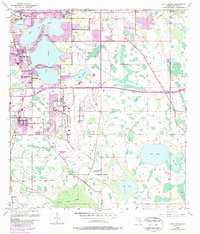
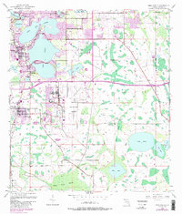
1953 Map of Pine Castle
USGS Topo · Published 1987About this map
Orlando International Airport occupies a central position on this landscape, its expansive runways and facilities highlighting the post-war aviation growth south of the Orlando city limits. This survey captures a transitional period for Orange County, where established lakefront communities like Belle Isle and Edgewood sit in contrast to the emerging infrastructure of the Bee Line Expressway Toll Road. To the south, the terrain remains defined by natural drainage systems like Boggy Creek Swamp and Bull Slough. Researchers will find significant genealogical and industrial data in the smaller settlements, particularly the rail-aligned community of Taft and the established town of Pine Castle, which sits between the interconnected basins of Lake Conway and Little Lake Conway. The map also preserves the location of Lock Cem near the southern marshes, offering a point of interest for local history studies.
Find a feature on this map
34 named features on this map. Tap any name to fly to it.
Don’t see what you’re looking for? This feature index may not catch every label — zoom into the map to look around manually.
Map Details
Editions of this 1953 Pine Castle Map
6 editions found
Other maps of this area

1953 · Lake Jessamine
USGS Topo · 1:24,000

1953 · St Cloud North
USGS Topo · 1:24,000

1953 · Narcoossee
USGS Topo · 1:24,000

1953 · Pine Castle
USGS Topo · 1:24,000

1953 · Kissimmee
USGS Topo · 1:24,000

1953 · Oviedo SW
USGS Topo · 1:24,000

1953 · Narcoossee NW
USGS Topo · 1:24,000

1955 · Orlando
USGS Topo · 1:250,000

1956 · Orlando West
USGS Topo · 1:24,000

1956 · Orlando East
USGS Topo · 1:24,000