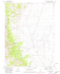
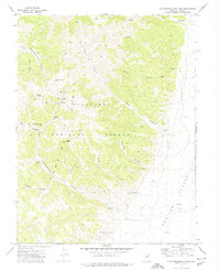
1971 Map of Pine Creek Ranch
USGS Topo · Published 1982About this map
Pine Creek Ranch sits at the base of the dramatic mountain front where the eastern edge of the Toiyabe National Forest meets the wide expanse of Monitor Valley. This 1970s landscape is defined by the transition from steep, trail-carved canyons like Red Rock Canyon and Bucks Pack Canyon to the alluvial floor. Drainage is central to the area's geography, with Pine Creek and various unnamed Spring sources flowing from the heights toward the valley. The map reveals the infrastructure of a working Great Basin ranching and mining landscape, noting several Borrow Pit locations and a network of Trail and Jeep Trail routes that navigate the canyons. The proximity of the ranch to these water sources and canyon mouths reflects a classic settlement pattern in Nevada, where life and industry clustered at the mountain-valley interface.
Find a feature on this map
13 named features on this map. Tap any name to fly to it.
Don’t see what you’re looking for? This feature index may not catch every label — zoom into the map to look around manually.
Map Details
Editions of this 1971 Pine Creek Ranch Map
2 editions found
Other maps of this area

1956 · Tonopah
USGS Topo · 1:250,000

1959 · Tonopah
USGS Topo · 1:250,000

1962 · Tonopah
USGS Topo · 1:250,000

1971 · Corcoran Canyon
USGS Topo · 1:24,000

1971 · Barley Creek
USGS Topo · 1:24,000

1971 · Mosquito Creek
USGS Topo · 1:24,000
1971 · Jet Spring
USGS Topo · 1:24,000
1971 · Box Spring
USGS Topo · 1:24,000
1971 · Northumberland Pass
USGS Topo · 1:24,000

1971 · Jefferson
USGS Topo · 1:24,000