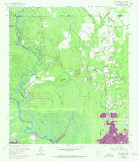
1960 Map of Pine Forest
USGS Topo · Published 1971About this map
The Neches River and its intricate network of bayous and sloughs dominate this 1960 landscape along the border of Orange, Hardin, and Jefferson counties. This survey, revised with 1970 data, illustrates the transition from the dense wetlands of Pine Island Bayou and Banks Bayou to the growing residential footprints of Vidor and Pine Forest. Industrial and agricultural infrastructure is evident in the North Oil Field and the expansive Wiess Canal, which cuts across the marshy terrain near Huckleberry Ridge. Local heritage is anchored by sites such as Williamson Cem, Williamson Ch, and Lakeview Ch. Notable river landmarks include the steep Bunns Bluff and the ferry or ford point at Lawson Crossing, while an Old Railroad Grade north of Vidor hints at the era of timber extraction that once defined this portion of Southeast Texas.
Find a feature on this map
44 named features on this map. Tap any name to fly to it.
Don’t see what you’re looking for? This feature index may not catch every label — zoom into the map to look around manually.
Map Details
Editions of this 1960 Pine Forest Map
3 editions found
Other maps of this area

1926 · Terry
USGS Topo · 1:24,000

1926 · Lakeview
USGS Topo · 1:24,000

1926 · Vidor
USGS Topo · 1:24,000

1926 · Texla
USGS Topo · 1:24,000

1932 · Beaumont
USGS Topo · 1:62,500

1943 · Terry
USGS Topo · 1:24,000

1943 · Texla
USGS Topo · 1:24,000

1943 · Beaumont East
USGS Topo · 1:24,000

1952 · Lake Charles
USGS Topo · 1:250,000

1954 · Lake Charles
USGS Topo · 1:250,000