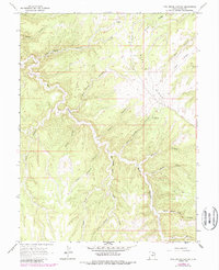
1966 Map of Pine Spring Canyon
USGS Topo · Published 1987About this map
Seep Ridge dominates this high-desert landscape in Uintah County, where a network of deeply incised canyons and industrial infrastructure reveals a remote region defined by resource extraction and rugged transit. The presence of Mayos Cabin and a Storage Bin near the northern boundary suggests localized ranching or early commercial activity, while the terrain is marked by descriptive names like Big Asphalt Canyon and Little Asphalt Canyon, likely referencing the bituminous sands common to the Uinta Basin.
Find a feature on this map
27 named features on this map. Tap any name to fly to it.
Don’t see what you’re looking for? This feature index may not catch every label — zoom into the map to look around manually.
Map Details
Editions of this 1966 Pine Spring Canyon Map
2 editions found
Other maps of this area

1885 · East Tavaputs
USGS Topo · 1:250,000

1956 · Grand Junction
USGS Topo · 1:250,000

1959 · Grand Junction
USGS Topo · 1:250,000

1960 · Grand Junction
USGS Topo · 1:250,000

1962 · Grand Junction
USGS Topo · 1:250,000

1963 · Tenmile Canyon
USGS Topo · 1:62,500

1964 · Grand Junction
USGS Topo · 1:250,000

1965 · Grand Junction
USGS Topo · 1:250,000

1966 · Seep Canyon
USGS Topo · 1:24,000

1966 · Bates Knolls
USGS Topo · 1:24,000