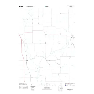
2013 Map of Pine Village
USGS Topo · Published 2013About this map
Pine Village serves as the primary hub in this portion of Warren County, where the intersection of state routes meets a network of established country roads. The landscape is defined by the winding course of Big Pine Cr, which draws in tributaries like Mud Pine Cr and Spring Br as it flows south toward the Wabash valley. Small rural clusters such as Rainsville and Hooker Corner anchor the agricultural uplands, while Brisco sits along the western corridor. This 2013 survey illustrates a classic Midwestern township structure, dominated by a precise grid of section-line roads like S Meridian Rd and W 800 S. The area maintains its rural character, with the creek bottoms providing the only significant break in the geometric pattern of farm fields and local homesteads.
Find a feature on this map
69 named features on this map. Tap any name to fly to it.
Don’t see what you’re looking for? This feature index may not catch every label — zoom into the map to look around manually.
Map Details
Editions of this 2013 Pine Village Map
This is the sole edition of this map. No revisions or reprints were ever made.
Other maps of this area

1953 · Danville
USGS Topo · 1:250,000

1955 · Danville
USGS Topo · 1:250,000

1956 · Danville
USGS Topo · 1:250,000

1961 · Chatterton
USGS Topo · 1:24,000

1961 · Tab
USGS Topo · 1:24,000

1961 · Pine Village
USGS Topo · 1:24,000

1961 · West Lebanon
USGS Topo · 1:24,000

1962 · Templeton
USGS Topo · 1:24,000

1962 · Boswell
USGS Topo · 1:24,000

1962 · Williamsport
USGS Topo · 1:24,000