
1960 Map of Pinetta
USGS Topo · Published 1961About this map
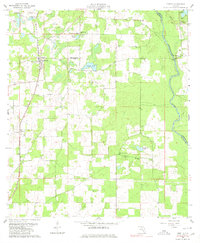
Pinetta and Hanson stand as the primary settlements in this rural Florida landscape, situated just south of the Georgia state line. The Valdosta Southern railroad provides a clear north-south transit corridor through the western half of the map, connecting these communities to regional markets. This 1960 survey highlights a dispersed network of spiritual and social centers, including Mt Horeb Ch, New Mt Moriah Ch, and Hickory Grove Ch. To the east, the Withlacoochee River forms a natural boundary between Hamilton and Madison counties, passing the small settlement of Bellville. The terrain is characterized by numerous small bodies of water such as Grassy Pond and Langford Pond, while the Gibson Lookout Tower provides a notable landmark for fire observation across the timbered tracts of North Florida.
Find a feature on this map
19 named features on this map. Tap any name to fly to it.
Don’t see what you’re looking for? This feature index may not catch every label — zoom into the map to look around manually.
Map Details
Editions of this 1960 Pinetta Map
4 editions found
Other maps of this area

1954 · Valdosta
USGS Topo · 1:250,000

1956 · Clyattville
USGS Topo · 1:24,000

1956 · Nankin
USGS Topo · 1:24,000

1956 · Octahatchee
USGS Topo · 1:24,000

1958 · Valdosta
USGS Topo · 1:250,000

1958 · Lee
USGS Topo · 1:24,000

1959 · Valdosta
USGS Topo · 1:250,000

1959 · Madison
USGS Topo · 1:24,000

1959 · Ellaville
USGS Topo · 1:24,000

1960 · Cherry Lake
USGS Topo · 1:24,000