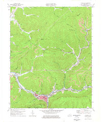
1974 Map of Pineville
USGS Topo · Published 1977About this map
Pineville serves as the focal point of this Bell County landscape, tucked within a loop of the Cumberland River at the foot of Pine Mountain. The mid-1970s terrain reflects a dense overlap of transport, industry, and nature, where the Louisville and Nashville Railroad and the historic Wilderness Road follow the river corridors. The surrounding hillsides are heavily marked by resource extraction, featuring numerous Strip Mine sites and smaller Mines that define the local economy of the era.
Find a feature on this map
61 named features on this map. Tap any name to fly to it.
Don’t see what you’re looking for? This feature index may not catch every label — zoom into the map to look around manually.
Map Details
Editions of this 1974 Pineville Map
This is the sole edition of this map. No revisions or reprints were ever made.
Other maps of this area

1886 · Cumberland Gap
USGS Topo · 1:125,000

1888 · Cumberland Gap
USGS Topo · 1:125,000

1891 · Cumberland Gap
USGS Topo · 1:125,000

1903 · Pineville
USGS Topo · 1:48,000

1903 · Middlesboro
USGS Topo · 1:48,000

1927 · Middlesboro
USGS Topo · 1:62,500

1930 · Middlesboro
USGS Topo · 1:62,500

1935 · Varilla
USGS Topo · 1:24,000

1952 · Fount
USGS Topo · 1:24,000
1952 · Artemus
USGS Topo · 1:24,000