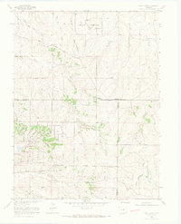
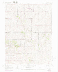
1966 Map of Piney Creek
USGS Topo · Published 1967About this map
The Military Reservation sits at the northern edge of this Colorado landscape, characterized by the diverging drainages of West Toll Gate Creek and East Toll Gate Creek. This 1966 survey, revised by the Inter-County Regional Planning Commission, captures the transition of the high plains before major suburban expansion. Strategic infrastructure like a Radar Facility and a Radio Tower appear alongside historical transit corridors such as Smoky Hill Road and East Parker Road. The drainage patterns are intricate, with seasonal watercourses like Sulphur Gulch, Baldwin Gulch, and Sampson Gulch cutting through the terrain. A small Cem and an Observation Tower provide specific points of interest for genealogists and local historians, while scattered Gravel Pits indicate the early industrial activity in the region.
Find a feature on this map
22 named features on this map. Tap any name to fly to it.
Don’t see what you’re looking for? This feature index may not catch every label — zoom into the map to look around manually.
Map Details
Editions of this 1966 Piney Creek Map
6 editions found
Other maps of this area

1890 · East Denver
USGS Topo · 1:125,000

1894 · Castle Rock
USGS Topo · 1:125,000

1913 · Castle Rock
USGS Topo · 1:125,000

1935 · East Denver Nos. 3 and 4
USGS Topo · 1:48,000

1939 · Coal Creek
USGS Topo · 1:24,000

1939 · Elizabeth
USGS Topo · 1:62,500

1940 · Piney Creek
USGS Topo · 1:24,000

1940 · Castle Rock
USGS Topo · 1:62,500

1941 · Fitzsimons
USGS Topo · 1:31,680

1942 · Parker
USGS Topo · 1:31,680