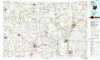
1986 Map of Piqua
USGS Topo · Published 1992About this map
Fort Recovery, Fort Jefferson, and Fort Loramie anchor the historical geography of this Western Ohio and Eastern Indiana borderlands region during the 1980s. The landscape is defined by the headwaters of several major drainage systems, including the Wabash River, St Marys River, and the Miami River. This survey captures the rural character and industrial intersections of the era, where the Baltimore & Ohio RR and Norfolk & Western RR lines crisscross the grid of county roads connecting settlements like Versailles, Covington, and Winchester. Extensive water management and conservation efforts are evident in the presence of Grand Lake St Marys, the Mercer County Waterfowl Management Area, and the Darke State Wildlife Area. Local heritage is preserved in numerous rural landmarks, from the St Henry Ch to the Miami Memorial Park Cem, reflecting a long-standing pattern of community development centered around the region's fertile plains and river valleys.
Find a feature on this map
225 named features on this map. Tap any name to fly to it.
Don’t see what you’re looking for? This feature index may not catch every label — zoom into the map to look around manually.
Map Details
Editions of this 1986 Piqua Map
3 editions found
Other maps of this area

1904 · Springfield
USGS Topo · 1:62,500

1904 · Dayton
USGS Topo · 1:62,500

1905 · Brookville
USGS Topo · 1:62,500

1906 · Dayton
USGS Topo · 1:62,500

1906 · Springfield
USGS Topo · 1:62,500

1906 · Lima
USGS Topo · 1:62,500

1908 · St. Henry
USGS Topo · 1:62,500

1909 · Loramie
USGS Topo · 1:62,500

1911 · Berne
USGS Topo · 1:48,000

1911 · Loramie
USGS Topo · 1:62,500