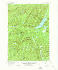
1954 Map of Piseco Lake
USGS Topo · Published 1975About this map
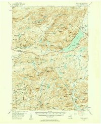
Piseco and the surrounding wilderness of the Adirondack State Park are captured in this mid-century survey, revealing a landscape defined by deep-water lakes and high peaks. The eastern shore of Piseco Lake serves as a hub for recreational development, shown through the establishment of the Poplar Point State Campsite, Little Sand Point State Campsite, and Point Comfort State Campsite. Further west, the settlement of Hoffmeister and the Morehouseville Cem mark the human footprint near the South Branch of Canada Creek.
Find a feature on this map
197 named features on this map. Tap any name to fly to it.
Don’t see what you’re looking for? This feature index may not catch every label — zoom into the map to look around manually.
Map Details
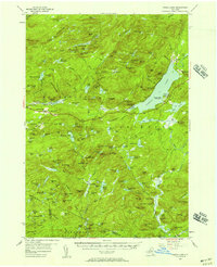
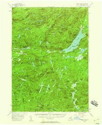
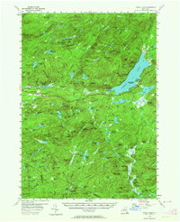
Editions of this 1954 Piseco Lake Map
5 editions found
Other maps of this area

1899 · Indian Lake
USGS Topo · 1:62,500

1900 · Little Falls
USGS Topo · 1:62,500

1900 · Canada Lake
USGS Topo · 1:62,500

1900 · Wilmurt
USGS Topo · 1:62,500

1901 · Old Forge
USGS Topo · 1:62,500

1901 · Lassellsville
USGS Topo · 1:62,500

1902 · Wilmurt
USGS Topo · 1:62,500

1902 · Indian Lake
USGS Topo · 1:62,500

1903 · West Canada Lakes
USGS Topo · 1:62,500

1903 · Gloversville
USGS Topo · 1:62,500