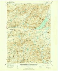
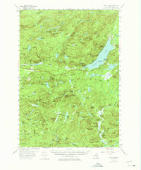
1954 Map of Piseco Lake
USGS Topo · Published 1975About this map
Piseco Lake and the surrounding Adirondack wilderness are captured here in the mid-1950s, revealing a landscape defined by its deep basins and prominent ridges like the Metcalf Range. Small settlements and seasonal outposts dot the shoreline and forest interior, including Rudeston, Higgins Bay, and the clustered dwellings at Morehouseville and Hoffmeister. The map documents the early infrastructure of the park, showing lakeside public spaces such as Poplar Point State Campsite and the rugged Northville Lake Placid Trail as it winds past T Lake Falls. Named clearings and family-identified landmarks like Averys Place and Shaker Place suggest a history of localized settlement and forestry. Between the summits of Panther Mountain and Big Goldmine Hill, the drainage of the Sacandaga River and Piseco Outlet forms a complex network of wetlands and mountain lakes including Spy Lake and Sand Lake.
Find a feature on this map
183 named features on this map. Tap any name to fly to it.
Don’t see what you’re looking for? This feature index may not catch every label — zoom into the map to look around manually.
Map Details
Editions of this 1954 Piseco Lake Map
5 editions found
Other maps of this area

1899 · Indian Lake
USGS Topo · 1:62,500

1900 · Little Falls
USGS Topo · 1:62,500

1900 · Canada Lake
USGS Topo · 1:62,500

1900 · Wilmurt
USGS Topo · 1:62,500

1901 · Old Forge
USGS Topo · 1:62,500

1901 · Lassellsville
USGS Topo · 1:62,500

1902 · Wilmurt
USGS Topo · 1:62,500

1902 · Indian Lake
USGS Topo · 1:62,500

1903 · West Canada Lakes
USGS Topo · 1:62,500

1903 · Gloversville
USGS Topo · 1:62,500