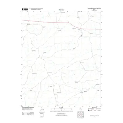
2012 Map of Pitchfork Ranch
USGS Topo · Published 2012About this map
Pitchfork Ranch anchors this West Texas landscape, a region defined by its reliance on subterranean water sources and the sprawling network of its water infrastructure. The map depicts a rugged terrain dissected by drainage systems like the S Wichita River, Brushy Cr, and Salt Cr, which carve out notable geological formations such as Davidson Canyon and Flakemoore Canyon. The distribution of named windmills across the ranch land—including the James Hodge Windmill, Matador Windmill, and Fortyone Windmill—illustrates the intensive ranching operations of the early 21st century. These landmarks, along with features like Devils Playground and Hanna Draw, provide a unique spatial record of the nomenclature and environmental adaptations common to King County’s cattle-raising heritage.
Find a feature on this map
36 named features on this map. Tap any name to fly to it.
Don’t see what you’re looking for? This feature index may not catch every label — zoom into the map to look around manually.
Map Details
Editions of this 2012 Pitchfork Ranch Map
This is the sole edition of this map. No revisions or reprints were ever made.
Other maps of this area

1954 · Lubbock
USGS Topo · 1:250,000

1958 · Pursley House
USGS Topo · 1:24,000

1958 · Southerland Canyon
USGS Topo · 1:24,000

1959 · Gilpin
USGS Topo · 1:24,000

1967 · Guthrie NW
USGS Topo · 1:24,000

1968 · East Afton
USGS Topo · 1:24,000

1968 · Pitchfork Ranch
USGS Topo · 1:24,000

1968 · Croton Camp
USGS Topo · 1:24,000

1968 · East Afton NE
USGS Topo · 1:24,000

1968 · Pitchfork Flats
USGS Topo · 1:24,000