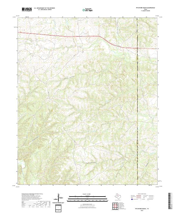
2022 Map of Pitchfork Ranch
USGS Topo · Published 2022About this map
S Wichita River and Geneva Fork define the northern drainage of this territory on the boundary of Dickens and King counties. This landscape is characterized by an intricate network of erosional features, including Davidson Canyon and the uniquely named T Fortyone Canyon to the west. The drainage patterns shift south of Highway 82 and 114, where Brushy Cr and Salt Cr flow through deeply incised terrain toward the N Croton Cr basin. Flakemoore Canyon and Hanna Draw provide evidence of the complex hydrology that has shaped these ranchlands over decades. The map shows the intersection of local transportation routes like Co RD 371 with the primary highway corridor, illustrating how contemporary infrastructure navigates the broken ground of the West Texas plains.
Find a feature on this map
16 named features on this map. Tap any name to fly to it.
Don’t see what you’re looking for? This feature index may not catch every label — zoom into the map to look around manually.
Map Details
Editions of this 2022 Pitchfork Ranch Map
This is the sole edition of this map. No revisions or reprints were ever made.
Other maps of this area

1954 · Lubbock
USGS Topo · 1:250,000

1958 · Pursley House
USGS Topo · 1:24,000

1958 · Southerland Canyon
USGS Topo · 1:24,000

1959 · Gilpin
USGS Topo · 1:24,000

1967 · Guthrie NW
USGS Topo · 1:24,000

1968 · East Afton
USGS Topo · 1:24,000

1968 · Pitchfork Ranch
USGS Topo · 1:24,000

1968 · Croton Camp
USGS Topo · 1:24,000

1968 · East Afton NE
USGS Topo · 1:24,000

1968 · Pitchfork Flats
USGS Topo · 1:24,000