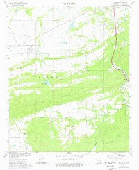
1967 Map of Pittsburg
USGS Topo · Published 1978About this map
The town of Pittsburg sits at the northern foot of Kiowa Mountain, where the local landscape is defined by the sharp transition between the valley floor and the dramatic ridges of Limestone Ridge and Pine Mountain. This late-1960s survey illustrates a region shaped by resource extraction and evolving transportation, featuring a prominent Mine and an Old Railroad Grade that once connected these hills to wider markets. While older landmarks like Union Chapel and three distinct burial grounds—Pittsburg Cem, Calvary Cem, and Pleasant Valley Cem—point to established community roots, the arrival of the Indian Nation Toll Road Turnpike slicing through the eastern hills signals a modern era for the county. Water is central to the area's layout, from the engineered Pittsburg Lake and Storrie Lake to the natural winding course of Brushy Creek.
Find a feature on this map
21 named features on this map. Tap any name to fly to it.
Don’t see what you’re looking for? This feature index may not catch every label — zoom into the map to look around manually.
Map Details
Editions of this 1967 Pittsburg Map
2 editions found
Other maps of this area

1898 · McAlester
USGS Topo · 1:125,000

1909 · Mc Alester
USGS Topo · 1:125,000

1950 · Mcalester
USGS Topo · 1:250,000

1957 · Limestone Gap
USGS Topo · 1:24,000

1962 · McAlester
USGS Topo · 1:250,000

1965 · McAlester
USGS Topo · 1:250,000

1967 · Pittsburg
USGS Topo · 1:24,000
1967 · Mc Alester SW
USGS Topo · 1:24,000
1967 · Kiowa
USGS Topo · 1:24,000

1967 · Hartshorne SW
USGS Topo · 1:24,000