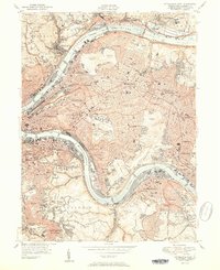
1951 Map of Pittsburgh East
USGS Topo · Published 1951About this map
The confluence of heavy industry and urban institutional growth is clearly defined along the Allegheny River and Monongahela River in this mid-century survey. The landscape is dominated by the dense street grids of Pittsburgh and the massive park and cemetery tracts that break up the residential developments of Oakland and Squirrel Hill. Major landmarks of the era are meticulously plotted, including the Cathedral of Learning at the University of Pittsburgh and the nearby Forbes Field, reflecting the city's cultural and athletic centers before the era of modern stadium construction.
Find a feature on this map
111 named features on this map. Tap any name to fly to it.
Don’t see what you’re looking for? This feature index may not catch every label — zoom into the map to look around manually.
Map Details
Editions of this 1951 Pittsburgh East Map
3 editions found

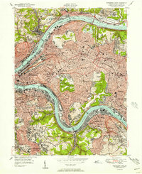
Other maps of this area

1904 · Mc Keesport
USGS Topo · 1:62,500

1904 · Carnegie
USGS Topo · 1:62,500

1906 · Carnegie
USGS Topo · 1:62,500

1906 · Sewickley
USGS Topo · 1:62,500

1907 · Pittsburg
USGS Topo · 1:62,500

1908 · Sewickley
USGS Topo · 1:62,500

1908 · Carnegie
USGS Topo · 1:62,500

1908 · New Kensington
USGS Topo · 1:62,500

1910 · New Kensington
USGS Topo · 1:62,500

1948 · Pittsburgh West
USGS Topo · 1:24,000