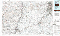
1986 Map of Pittsburgh West
USGS Topo · Published 1986About this map
Industrial and rural landscapes intersect along the Ohio River in this mid-1980s planimetric study. The map documents a critical period for the Ohio Valley and Western Pennsylvania, showing the heavy rail infrastructure of the Conrail and Chessie System lines that serviced the region's coal and steel interests. The heavy industrial footprint of Nelms Mine No 1 and Mine No 60 contrasts with the surrounding topography, characterized by ridges like Simmons Ridge and localized landmarks such as Galloway Knob.
Find a feature on this map
198 named features on this map. Tap any name to fly to it.
Don’t see what you’re looking for? This feature index may not catch every label — zoom into the map to look around manually.
Map Details
Editions of this 1986 Pittsburgh West Map
3 editions found
Other maps of this area

1900 · Masontown
USGS Topo · 1:62,500

1901 · Cadiz
USGS Topo · 1:62,500

1901 · Amity
USGS Topo · 1:62,500

1901 · Waynesburg
USGS Topo · 1:62,500

1901 · Beaver
USGS Topo · 1:62,500

1902 · Wheeling
USGS Topo · 1:62,500

1902 · Brownsville
USGS Topo · 1:62,500

1902 · Scio
USGS Topo · 1:62,500

1903 · Masontown
USGS Topo · 1:62,500

1903 · Cadiz
USGS Topo · 1:62,500