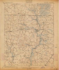
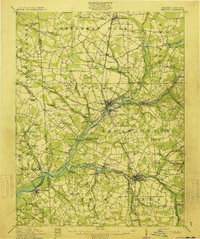
1902 Map of Pittsville
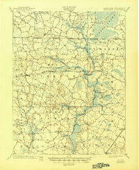
USGS Topo · Published 1945About this map
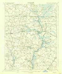
The Pocomoke River basin dominates this agricultural and swamp-edge landscape at the dawn of the 20th century. The intricate waterways of the Cypress Swamp and its various tributaries, including Cypress Branch and Gum Branch, define the northern terrain where Maryland and Delaware meet. Local commerce and travel are anchored by the Baltimore and Eastern Shore R.R., which connects the central villages of Parsonsburg, Pittsville, and Willards.
Find a feature on this map
66 named features on this map. Tap any name to fly to it.
Don’t see what you’re looking for? This feature index may not catch every label — zoom into the map to look around manually.
Map Details
Editions of this 1902 Pittsville Map
4 editions found
Other maps of this area

1901 · Snow Hill
USGS Topo · 1:62,500

1901 · Salisbury
USGS Topo · 1:62,500
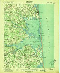
1901 · Green Run
USGS Topo · 1:62,500
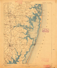
1901 · Ocean City
USGS Topo · 1:62,500

1902 · Pittsville
USGS Topo · 1:62,500
1915 · Seaford
USGS Topo · 1:62,500

1917 · Millsboro
USGS Topo · 1:62,500
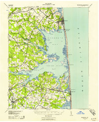
1918 · Rehoboth
USGS Topo · 1:62,500

1938 · Millsboro
USGS Topo · 1:62,500
1938 · Rehoboth
USGS Topo · 1:62,500