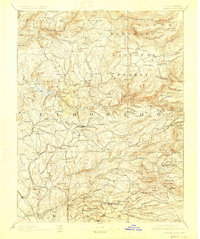
1893 Map of Placerville
USGS Topo · Published 1928About this map
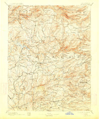
The Sacramento and Placerville Railroad terminates in this late-19th-century study of California's Gold Country, documenting the complex network of mining camps and early timber operations. The map provides a remarkable view of the terrain around Coloma, the site of the first gold discovery, and extends through the deep drainages of the North Fork American River and South Fork American River.
Find a feature on this map
214 named features on this map. Tap any name to fly to it.
Don’t see what you’re looking for? This feature index may not catch every label — zoom into the map to look around manually.
Map Details
Editions of this 1893 Placerville Map
9 editions found

Other maps of this area

1888 · Smartsville
USGS Topo · 1:125,000

1889 · Jackson
USGS Topo · 1:125,000

1889 · Pyramid Peak
USGS Topo · 1:125,000

1891 · Sacramento
USGS Topo · 1:125,000

1891 · Colfax
USGS Topo · 1:125,000

1891 · Truckee
USGS Topo · 1:125,000

1891 · Big Trees
USGS Topo · 1:125,000

1891 · Smartsville
USGS Topo · 1:125,000

1891 · Placerville
USGS Topo · 1:125,000

1891 · Pyramid Peak
USGS Topo · 1:125,000