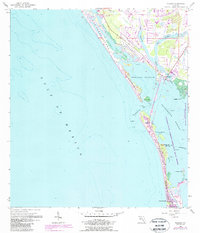
1957 Map of Placida
USGS Topo · Published 1987About this map
Placida Harbor and the barrier island chain of Charlotte County are shown here as they appeared during the mid-century, with updates reflecting coastal development through the 1980s. The settlement of Placida serves as a mainland hub, while the southern tip of the map features the established community of Boca Grande. The geography is defined by a complex network of waterways, including Coral Creek and the West Branch, which separate the mainland from islands like Don Pedro Island and Little Gasparilla Island.
Find a feature on this map
25 named features on this map. Tap any name to fly to it.
Don’t see what you’re looking for? This feature index may not catch every label — zoom into the map to look around manually.
Map Details
Editions of this 1957 Placida Map
4 editions found
Other maps of this area

1956 · Englewood
USGS Topo · 1:24,000

1956 · Tampa
USGS Topo · 1:250,000

1956 · Charlotte Harbor
USGS Topo · 1:250,000

1957 · Englewood NW
USGS Topo · 1:24,000

1957 · El Jobean
USGS Topo · 1:24,000

1957 · Punta Gorda SW
USGS Topo · 1:24,000

1957 · Placida
USGS Topo · 1:24,000

1958 · Port Boca Grande
USGS Topo · 1:24,000

1958 · Bokeelia
USGS Topo · 1:24,000

1959 · Tampa
USGS Topo · 1:250,000