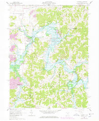
1962 Map of Plainfield
USGS Topo · Published 1978About this map
Wills Creek Lake dominates this 1962 landscape, reflecting the heavy hand of the Muskingum Watershed Conservancy District on the local topography. This region of Ohio, documented here just before a 1970s update, shows a transition from traditional agricultural settlements like Lafayette and Plainfield to a landscape increasingly shaped by resource extraction and flood control. The presence of numerous Strip Mines in the northern townships and clusters of Gas Wells to the south reveals the industrial underpinnings of the area's economy during the mid-century. Genealogists will find significant value in the distribution of family-connected sites such as Schweitzer Cem and Union Hill Cem, alongside community landmarks like Grange Hall and the rural Lafayette Center school. The map also captures specialized transport features, including the Porteus Landing Strip tucked along the northern creek banks.
Find a feature on this map
37 named features on this map. Tap any name to fly to it.
Don’t see what you’re looking for? This feature index may not catch every label — zoom into the map to look around manually.
Map Details
Editions of this 1962 Plainfield Map
4 editions found
Other maps of this area

1908 · Conesville
USGS Topo · 1:62,500

1909 · Cambridge
USGS Topo · 1:62,500

1910 · Conesville
USGS Topo · 1:62,500

1911 · Newcomerstown
USGS Topo · 1:62,500

1912 · Cambridge
USGS Topo · 1:62,500

1913 · Newcomerstown
USGS Topo · 1:62,500

1913 · Coshocton
USGS Topo · 1:62,500

1915 · Coshocton
USGS Topo · 1:62,500

1943 · Coshocton
USGS Topo · 1:62,500

1943 · Newcomerstown
USGS Topo · 1:62,500