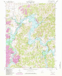
1962 Map of Plainfield
USGS Topo · Published 1984About this map
The Wills Creek Lake reservoir system dominates this landscape at the intersection of Coshocton, Guernsey, and Muskingum Counties. Managed by the Muskingum Watershed Conservancy District, the reservoir's irregular shoreline winds through the townships of Linton, Wheeling, and Oxford. The village of Plainfield sits near the western banks, serving as a local hub alongside smaller settlements like Linton Mills and Birds Run.
Find a feature on this map
35 named features on this map. Tap any name to fly to it.
Don’t see what you’re looking for? This feature index may not catch every label — zoom into the map to look around manually.
Map Details
Editions of this 1962 Plainfield Map
4 editions found
Other maps of this area

1908 · Conesville
USGS Topo · 1:62,500

1909 · Cambridge
USGS Topo · 1:62,500

1910 · Conesville
USGS Topo · 1:62,500

1911 · Newcomerstown
USGS Topo · 1:62,500

1912 · Cambridge
USGS Topo · 1:62,500

1913 · Newcomerstown
USGS Topo · 1:62,500

1913 · Coshocton
USGS Topo · 1:62,500

1915 · Coshocton
USGS Topo · 1:62,500

1943 · Coshocton
USGS Topo · 1:62,500

1943 · Newcomerstown
USGS Topo · 1:62,500