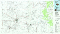
1985 Map of Plainview
USGS Topo · Published 1985About this map
The Caprock Escarpment provides a dramatic transition on this 1985 survey, where the flat High Plains of the Llano Estacado meet the broken canyonlands to the east. Within Caprock Canyon State Park, the terrain drops into Pole Canyon and Dobbs Hollow, carved by the headwaters of Quitaque Creek and Los Lingos Creek. This landscape is defined by its agricultural grid, with the city of Plainview serving as a central hub for the surrounding smaller communities like Edmonson and Kress.
Find a feature on this map
62 named features on this map. Tap any name to fly to it.
Don’t see what you’re looking for? This feature index may not catch every label — zoom into the map to look around manually.
Map Details
Editions of this 1985 Plainview Map
2 editions found
Other maps of this area

1954 · Lubbock
USGS Topo · 1:250,000

1954 · Plainview
USGS Topo · 1:250,000

1954 · Clovis
USGS Topo · 1:250,000

1954 · Brownfield
USGS Topo · 1:250,000

1957 · Anton
USGS Topo · 1:62,500

1957 · Abernathy
USGS Topo · 1:62,500

1958 · Brownfield
USGS Topo · 1:250,000

1958 · Clovis
USGS Topo · 1:250,000

1958 · Plainview
USGS Topo · 1:250,000

1960 · Indian Peak
USGS Topo · 1:62,500