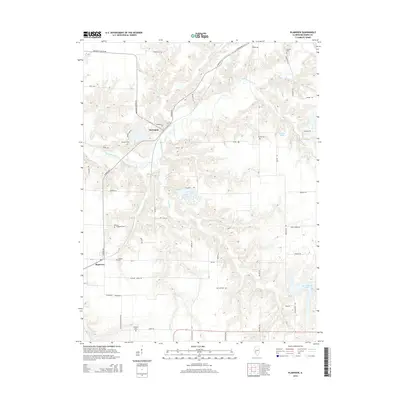
2015 Map of Plainview
USGS Topo · Published 2015About this map
The settlement of Plainview anchors the southwestern portion of this Macoupin County landscape, where the terrain is defined by a dense network of drainages feeding into Macoupin Creek. Small hamlets and named locales like Macoupin are situated among a collection of rural cemeteries that offer significant value for genealogical research, including Emerick Cem, Hacke Cem, and Brayford Cem. The geography is further shaped by local water bodies such as Lake Catatoga and Suhling Pond, alongside numerous named branches like Spanish Needle Cr and Hurricane Cr. The distribution of family-named burial sites such as Waggoner Cem and Combes Cem suggests a long history of generational land ownership across the township lines. Roadways like Shipman Rd and Dorchester Rd provide the primary transit corridors through this agricultural region, connecting isolated farmsteads to the larger water features like New Gillespie Lake.
Find a feature on this map
60 named features on this map. Tap any name to fly to it.
Don’t see what you’re looking for? This feature index may not catch every label — zoom into the map to look around manually.
Map Details
Editions of this 2015 Plainview Map
This is the sole edition of this map. No revisions or reprints were ever made.
Other maps of this area

1912 · Gillespie
USGS Topo · 1:62,500

1915 · Gillespie
USGS Topo · 1:62,500

1923 · Carlinville
USGS Topo · 1:48,000

1925 · Carlinville
USGS Topo · 1:62,500

1925 · Brighton
USGS Topo · 1:62,500

1928 · Brighton
USGS Topo · 1:62,500

1931 · Carlinville
USGS Topo · 1:62,500

1932 · Greenfield
USGS Topo · 1:62,500

1948 · Quincy
USGS Topo · 1:250,000

1956 · Quincy
USGS Topo · 1:250,000