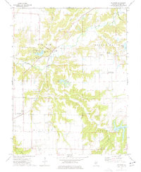
1974 Map of Plainview
USGS Topo · Published 1977About this map
Macoupin Creek meanders across this rural Illinois landscape, defining the topography of central Macoupin County in the mid-1970s. The sheet is anchored by the community of Plainview and the extensive Beaver Dam State Park, which encompasses Beaver Dam Lake and its associated campgrounds. This area showcases a transitional landscape where agriculture meets managed recreation, with smaller water bodies like Lake Catatoga and Suhling Pond punctuating the wooded drainages. The influence of family history is evident in the numerous burial grounds scattered throughout the townships, including Emerick Cem, Wagoner Cem, and Combes Cem. Transportation corridors are marked by the Illinois Terminal rail line and the small settlement of Macoupin. Evidence of local industry appears at the Quarry near the western edge of Hilyard township, while the Spanish Needle Community Center serves as a gathering point for the neighboring Brushy Mound area.
Find a feature on this map
34 named features on this map. Tap any name to fly to it.
Don’t see what you’re looking for? This feature index may not catch every label — zoom into the map to look around manually.
Map Details
Editions of this 1974 Plainview Map
This is the sole edition of this map. No revisions or reprints were ever made.
Other maps of this area

1912 · Gillespie
USGS Topo · 1:62,500

1915 · Gillespie
USGS Topo · 1:62,500

1923 · Carlinville
USGS Topo · 1:48,000

1925 · Carlinville
USGS Topo · 1:62,500

1925 · Brighton
USGS Topo · 1:62,500

1928 · Brighton
USGS Topo · 1:62,500

1931 · Carlinville
USGS Topo · 1:62,500

1932 · Greenfield
USGS Topo · 1:62,500

1948 · Quincy
USGS Topo · 1:250,000

1956 · Quincy
USGS Topo · 1:250,000