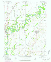
1957 Map of Plainville
USGS Topo · Published 1981About this map
White River meanders in tight oxbows across the flatlands of Daviess and Knox counties, defining the agricultural character of this region. The landscape is heavily engineered for water management, featuring an extensive network of drainage projects such as Armuth Ditch, Singer Ditch, and Pollard DITCH. High ground like Harbstrait Hill rises above the alluvial plain, while The Lagoon sits near the Conrail rail line. Local industry is clearly visible through clustered oil wells, oil tanks, and grain bins near Plainville.
Find a feature on this map
38 named features on this map. Tap any name to fly to it.
Don’t see what you’re looking for? This feature index may not catch every label — zoom into the map to look around manually.
Map Details
Editions of this 1957 Plainville Map
3 editions found
Other maps of this area

1943 · Lyons
USGS Topo · 1:24,000

1943 · Sandborn
USGS Topo · 1:24,000

1943 · Bicknell
USGS Topo · 1:24,000

1943 · Plainville
USGS Topo · 1:24,000

1943 · Epsom
USGS Topo · 1:24,000

1944 · Bucktown
USGS Topo · 1:24,000

1944 · Montgomery
USGS Topo · 1:24,000

1944 · Washington
USGS Topo · 1:24,000

1944 · Wheatland
USGS Topo · 1:24,000

1956 · Vincennes
USGS Topo · 1:250,000