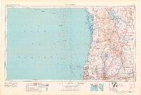
1955 Map of Plant City
USGS Topo · Published 1966About this map
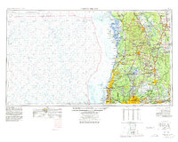
The Gulf Coast of Florida from the Anclote Keys up to Crystal River is documented here during a period of significant mid-century growth. Inland, the map follows the north-south transport corridors of the Atlantic Coast Line and Seaboard Air Line railroads, which linked the agricultural interior near Plant City and Dade City to the burgeoning urban center of Tampa. The landscape is defined by its complex hydrologic networks, from the spring-fed waters of Homosassa Springs to the expansive wetlands of Lake Tsala Apopka and the Withlacoochee River.
Find a feature on this map
66 named features on this map. Tap any name to fly to it.
Don’t see what you’re looking for? This feature index may not catch every label — zoom into the map to look around manually.
Map Details
Editions of this 1955 Plant City Map
6 editions found

Other maps of this area

1892 · Dunnellon
USGS Topo · 1:62,500

1893 · Panasoffkee
USGS Topo · 1:62,500

1894 · Dunnellon
USGS Topo · 1:62,500

1895 · Tsala Apopka
USGS Topo · 1:62,500

1895 · Panasoffkee
USGS Topo · 1:62,500

1895 · Ocala
USGS Topo · 1:62,500

1921 · Sand Key
USGS Topo · 1:62,500

1921 · Tampa
USGS Topo · 1:62,500

1921 · St Petersburg
USGS Topo · 1:62,500

1943 · Gandy Bridge
USGS Topo · 1:31,680