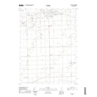
2021 Map of Plattville
USGS Topo · Published 2021About this map
Yorkville serves as the northern anchor for this landscape where residential expansion meets established agricultural traditions. The southern edge of the city shows a network of modern subdivisions with names like Country Hills Dr and Greenfield Turn juxtaposed against historic transit routes such as the Stagecoach Trl. As the terrain moves south toward Lisbon Center and Plattville, the map reveals a high density of rural religious and family heritage sites, including the Cross Evangelical Lutheran West Cem and Immanuel Lutheran Cem. These small settlements and cemeteries are connected by a grid of farm-to-market roads that cross the branches of the Middle Aux Sable Creek. The map documents a classic Midwestern transition where the growth of the county seat begins to reach the quiet hamlets of Helmar and Kentland.
Find a feature on this map
69 named features on this map. Tap any name to fly to it.
Don’t see what you’re looking for? This feature index may not catch every label — zoom into the map to look around manually.
Map Details
Editions of this 2021 Plattville Map
This is the sole edition of this map. No revisions or reprints were ever made.
Other maps of this area

1892 · Morris
USGS Topo · 1:62,500

1892 · Marseilles
USGS Topo · 1:62,500

1916 · Marseilles
USGS Topo · 1:62,500

1918 · Morris
USGS Topo · 1:62,500

1925 · Yorkville
USGS Topo · 1:62,500

1940 · Marseilles
USGS Topo · 1:62,500

1948 · Sandwich
USGS Topo · 1:62,500

1950 · Sandwich
USGS Topo · 1:62,500

1953 · Plattville
USGS Topo · 1:24,000

1953 · Lisbon
USGS Topo · 1:24,000