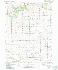
1993 Map of Plattville
USGS Topo · Published 1994About this map
Plattville and the surrounding townships of Kendall, Fox, Big Grove, and Lisbon define this agricultural landscape as it appeared in the early 1990s. The map illustrates a dense grid of rural roads such as Ament Road and Caton Farm Road connecting small crossroads settlements like Lisbon Center, Helmar, and Kentland. A significant historical landmark is the Chicago Indian Reservation Boundary, which cuts diagonally across the southern portion of the sheet near West Aux Sable Creek.
Find a feature on this map
37 named features on this map. Tap any name to fly to it.
Don’t see what you’re looking for? This feature index may not catch every label — zoom into the map to look around manually.
Map Details
Editions of this 1993 Plattville Map
This is the sole edition of this map. No revisions or reprints were ever made.
Other maps of this area

1892 · Morris
USGS Topo · 1:62,500

1892 · Marseilles
USGS Topo · 1:62,500

1916 · Marseilles
USGS Topo · 1:62,500

1918 · Morris
USGS Topo · 1:62,500

1925 · Yorkville
USGS Topo · 1:62,500

1940 · Marseilles
USGS Topo · 1:62,500

1948 · Sandwich
USGS Topo · 1:62,500

1950 · Sandwich
USGS Topo · 1:62,500

1953 · Plattville
USGS Topo · 1:24,000

1953 · Lisbon
USGS Topo · 1:24,000