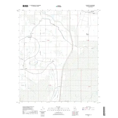
2018 Map of Plaucheville
USGS Topo · Published 2018About this map
Plaucheville serves as the primary hub in this corner of Avoyelles Parish, characterized by its grid of rural roads and an extensive network of waterways. The landscape is defined by the West Atchafalaya Floodway to the east, a critical piece of water management infrastructure that shapes the local geography. Numerous bayous, including Bayou Choupique, Bayou Jack, and Mill Bayou, wind through the terrain, illustrating the complex hydrography typical of this region.
Find a feature on this map
44 named features on this map. Tap any name to fly to it.
Don’t see what you’re looking for? This feature index may not catch every label — zoom into the map to look around manually.
Map Details
Editions of this 2018 Plaucheville Map
This is the sole edition of this map. No revisions or reprints were ever made.
Other maps of this area

1940 · Marksville
USGS Topo · 1:62,500

1941 · Voorhies
USGS Topo · 1:62,500

1948 · Bunkie
USGS Topo · 1:62,500

1952 · Lake Charles
USGS Topo · 1:250,000

1953 · Alexandria
USGS Topo · 1:250,000

1953 · Natchez
USGS Topo · 1:250,000

1954 · Lake Charles
USGS Topo · 1:250,000

1954 · Baton Rouge
USGS Topo · 1:250,000

1955 · Odenburg
USGS Topo · 1:62,500

1955 · Alexandria
USGS Topo · 1:250,000