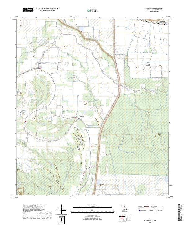
2024 Map of Plaucheville
USGS Topo · Published 2024About this map
The low-lying terrain of Avoyelles Parish is defined by an intricate network of waterways, including Bayou Choupique, Bayou Jack, and Bayou du Lac. The landscape is dominated by the West Atchafalaya Floodway to the east, a critical piece of water management infrastructure that protects the region. The primary settlement of Plaucheville serves as a local hub, connected to outlying hamlets like Dupont and Bodoc by a grid of rural roads and lanes. Local family names are etched into the geography through thoroughfares such as Levi Gremillion Rd, Guillory Rd, and Moncrief Plantation Ln. The map also captures the local services of the era, from the Plaucheville Cem to the WD-Flyers Airport near Rosewood. This survey details the transition from residential clusters to the dense wetlands and drainage systems that characterize south-central Louisiana.
Find a feature on this map
50 named features on this map. Tap any name to fly to it.
Don’t see what you’re looking for? This feature index may not catch every label — zoom into the map to look around manually.
Map Details
Editions of this 2024 Plaucheville Map
This is the sole edition of this map. No revisions or reprints were ever made.
Other maps of this area

1940 · Marksville
USGS Topo · 1:62,500

1941 · Voorhies
USGS Topo · 1:62,500

1948 · Bunkie
USGS Topo · 1:62,500

1952 · Lake Charles
USGS Topo · 1:250,000

1953 · Alexandria
USGS Topo · 1:250,000

1953 · Natchez
USGS Topo · 1:250,000

1954 · Lake Charles
USGS Topo · 1:250,000

1954 · Baton Rouge
USGS Topo · 1:250,000

1955 · Odenburg
USGS Topo · 1:62,500

1955 · Alexandria
USGS Topo · 1:250,000