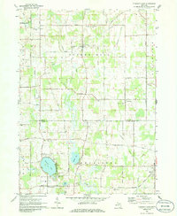
1970 Map of Pleasant Lake
USGS Topo · Published 1986About this map
Bunker Hill and the surrounding townships of Henrietta and Stockbridge define this rural Michigan landscape at the opening of the 1970s. The geography is characterized by a series of wetlands and lakes, notably Pleasant Lake and the larger Batttese Lake, which are connected by waterways like Batttese Creek and the Lake Drain. This area along the Ingham and Jackson County line shows a distinct pattern of small, dispersed settlements and agricultural infrastructure, with the village of Fitchburg serving as a local hub.
Find a feature on this map
48 named features on this map. Tap any name to fly to it.
Don’t see what you’re looking for? This feature index may not catch every label — zoom into the map to look around manually.
Map Details
Editions of this 1970 Pleasant Lake Map
3 editions found
Other maps of this area

1908 · Fowlerville
USGS Topo · 1:62,500

1909 · Mason
USGS Topo · 1:62,500

1910 · Fowlerville
USGS Topo · 1:62,500

1911 · Mason
USGS Topo · 1:62,500

1919 · Stockbridge
USGS Topo · 1:62,500

1919 · Rives Junction
USGS Topo · 1:62,500

1921 · Rives Junction
USGS Topo · 1:62,500

1922 · Stockbridge
USGS Topo · 1:62,500

1942 · Stockbridge
USGS Topo · 1:62,500

1958 · Grand Rapids
USGS Topo · 1:250,000
Featured Places
- Leslie Township, MI
- Bunker Hill Township, MI
- Rives Township, MI
- Stockbridge Township, MI
- Pleasant Lake, MI