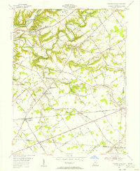
1955 Map of Pleasant Plain
USGS Topo · Published 1956About this map
The Little Miami River and Todd Fork carve through the landscape of Warren County in the mid-1950s, defining a region of small hamlets and dispersed family farms. Significant for genealogists, this survey captures numerous rural burying grounds such as Ruhyan Cem, Templin Cem, and Wesley Cem, alongside local landmarks like the Harlan-Butlerville Sch. The rail-centered commerce of Pleasant Plain is evident where the Baltimore and Ohio RR cuts across the southern agricultural plains.
Find a feature on this map
98 named features on this map. Tap any name to fly to it.
Don’t see what you’re looking for? This feature index may not catch every label — zoom into the map to look around manually.
Map Details
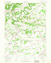
Editions of this 1955 Pleasant Plain Map
2 editions found
Other maps of this area

1907 · Blanchester
USGS Topo · 1:62,500

1914 · Batavia
USGS Topo · 1:48,000

1914 · Morrow
USGS Topo · 1:62,500

1916 · Batavia
USGS Topo · 1:62,500

1916 · Morrow
USGS Topo · 1:62,500

1917 · Sardinia
USGS Topo · 1:62,500

1944 · Sardinia
USGS Topo · 1:62,500

1947 · Columbus
USGS Topo · 1:250,000

1953 · Goshen
USGS Topo · 1:24,000

1953 · Newtonsville
USGS Topo · 1:24,000