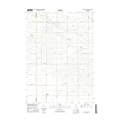
2017 Map of Pleasant Valley
USGS Topo · Published 2017About this map
Oil City stands at the northern edge of this landscape, reflecting the region's historical ties to the petroleum industry along the Chippewa River. Further south, the rural settlement of Pleasant Valley anchors a grid of agricultural lands and water management features. The area is defined by an intricate drainage network, including the naturally winding Thrasher Cr and Potter Cr, alongside man-made improvements like Kirch Drain and Frost Drain.
Find a feature on this map
59 named features on this map. Tap any name to fly to it.
Don’t see what you’re looking for? This feature index may not catch every label — zoom into the map to look around manually.
Map Details
Editions of this 2017 Pleasant Valley Map
This is the sole edition of this map. No revisions or reprints were ever made.
Other maps of this area

1930 · Shepherd
USGS Topo · 1:48,000

1934 · Sanford
USGS Topo · 1:62,500

1934 · Merrill
USGS Topo · 1:62,500

1935 · Alma
USGS Topo · 1:62,500

1936 · Shepherd
USGS Topo · 1:62,500

1936 · Sanford
USGS Topo · 1:62,500

1937 · Merrill
USGS Topo · 1:62,500

1938 · Alma
USGS Topo · 1:62,500

1954 · Midland
USGS Topo · 1:250,000

1958 · Midland
USGS Topo · 1:250,000