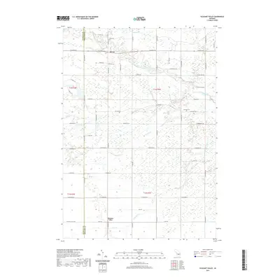
2019 Map of Pleasant Valley
USGS Topo · Published 2019About this map
Oil City sits at the northern edge of this Isabella and Midland County borderland, where the Chippewa River winds eastward through a landscape marked by a dense network of agricultural drains and small creeks. The terrain is defined by its water management, with features like Frost Drain, S Carl Drain, and Kirch Drain supporting the rural tracts surrounding Pleasant Valley. This survey captures the region's mid-century character, where family-named roads like N Magruder Rd and S Alamando Rd define the local geography. Local history is anchored by the presence of Kelly Cem and Greendale Cem, providing essential points of reference for genealogists researching the area's established families. The mapping of Thrasher Cr and Little Salt Cr illustrates the complex drainage required by the low-lying mid-Michigan territory.
Find a feature on this map
57 named features on this map. Tap any name to fly to it.
Don’t see what you’re looking for? This feature index may not catch every label — zoom into the map to look around manually.
Map Details
Editions of this 2019 Pleasant Valley Map
This is the sole edition of this map. No revisions or reprints were ever made.
Other maps of this area

1930 · Shepherd
USGS Topo · 1:48,000

1934 · Sanford
USGS Topo · 1:62,500

1934 · Merrill
USGS Topo · 1:62,500

1935 · Alma
USGS Topo · 1:62,500

1936 · Shepherd
USGS Topo · 1:62,500

1936 · Sanford
USGS Topo · 1:62,500

1937 · Merrill
USGS Topo · 1:62,500

1938 · Alma
USGS Topo · 1:62,500

1954 · Midland
USGS Topo · 1:250,000

1958 · Midland
USGS Topo · 1:250,000