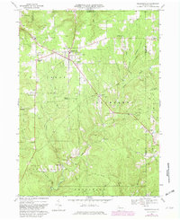
1967 Map of Pleasantville
USGS Topo · Published 1982About this map
The heritage of the Pennsylvania oil boom is etched across this landscape, which contains the Pithole City Historical Site and the remnants of Pithole City. By the late 1960s, the region was characterized by numerous oil fields including the Cattaraugus Oil Field and the Shamburg Oil Field. The map reveals a dense network of small rural settlements and family-named junctions such as Tyrrel Farm Corners, Lovell Corners, and Morrison Corners.
Find a feature on this map
46 named features on this map. Tap any name to fly to it.
Don’t see what you’re looking for? This feature index may not catch every label — zoom into the map to look around manually.
Map Details
Editions of this 1967 Pleasantville Map
Other maps of this area

1922 · Oil City
USGS Topo · 1:48,000

1922 · Tionesta
USGS Topo · 1:62,500

1924 · Oil City
USGS Topo · 1:62,500

1924 · Tionesta
USGS Topo · 1:62,500

1927 · Tidioute
USGS Topo · 1:48,000

1927 · Titusville
USGS Topo · 1:62,500

1930 · Tidioute
USGS Topo · 1:62,500

1933 · Titusville
USGS Topo · 1:62,500

1943 · Oil City
USGS Topo · 1:62,500

1946 · Tionesta
USGS Topo · 1:62,500
Featured Places
- Pleasantville, PA
- President Township, PA
- Cornplanter Township, PA
- Cattaraugus, Allegheny Township
- Tyrrel Farm Corners, Allegheny Township