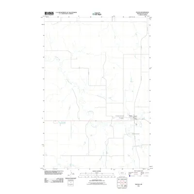
2011 Map of Plevna
USGS Topo · Published 2011About this map
Plevna serves as the central hub of this Eastern Montana landscape, situated where Main St meets the regional road network. The town's civic structure is well-defined by local landmarks including the Plevna Post Office and the Plevna Vol Fire Dist. For genealogists and local historians, the presence of three distinct burial grounds—Community Union Cemetery, Peace Lutheran Cemetery, and Saint Anthony Cemetery—suggests a community with diverse denominational roots. The terrain is shaped by the wandering path of Sandstone Creek, which meanders across the central portion of the quadrangle before being joined by the South Fork Sandstone Creek. In the southern reaches, the drainage of Hay Creek further defines the prairie geography, illustrating how water sources dictate the placement of rural roads like Road 318 and N Plevna Rd in this part of Fallon County.
Find a feature on this map
16 named features on this map. Tap any name to fly to it.
Don’t see what you’re looking for? This feature index may not catch every label — zoom into the map to look around manually.
Map Details
Editions of this 2011 Plevna Map
This is the sole edition of this map. No revisions or reprints were ever made.
Other maps of this area

1953 · Miles City
USGS Topo · 1:250,000

1957 · Miles City
USGS Topo · 1:250,000

1958 · Miles City
USGS Topo · 1:250,000

1981 · Baker
USGS Topo · 1:100,000

1981 · South Sandstone Reservoir
USGS Topo · 1:24,000

1981 · Lawrence Creek East
USGS Topo · 1:24,000

1981 · Lawrence Creek West
USGS Topo · 1:24,000

1981 · Little Pine Creek
USGS Topo · 1:24,000

1981 · Baker NW
USGS Topo · 1:24,000

1981 · Ayer Spring
USGS Topo · 1:24,000