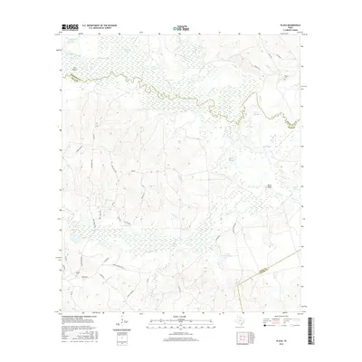
2016 Map of Pluck
USGS Topo · Published 2016About this map
The Neches River defines the border between Polk and Angelina counties in this section of East Texas, weaving through a landscape dominated by complex wetlands and sloughs. This riparian environment is marked by features like Lamar Slough, Dollarhide Lake, and The Island, illustrating the shifting course of the river over time. Upland from the bottomlands, the map reveals the scattered rural settlement patterns of the mid-2010s, including small communities like Eureka and Conley's Corner. Cultural landmarks significant for genealogical research include Stryker Cem in the southwest and Grimes Cem in the northeast. The geography transitions from the wet lowlands of Georges Prairie Pond to the slightly higher ground of Peach Ridge, with a network of local roads such as Wolf Hill Loop and Red Ball Rd connecting these remote homesteads and timberlands.
Find a feature on this map
56 named features on this map. Tap any name to fly to it.
Don’t see what you’re looking for? This feature index may not catch every label — zoom into the map to look around manually.
Map Details
Editions of this 2016 Pluck Map
This is the sole edition of this map. No revisions or reprints were ever made.
Other maps of this area

1927 · Lufkin 4-c
USGS Topo · 1:24,000

1928 · Lufkin 4-d
USGS Topo · 1:24,000

1932 · Manning
USGS Topo · 1:62,500

1953 · Palestine
USGS Topo · 1:250,000

1954 · Beaumont
USGS Topo · 1:250,000

1955 · Camden
USGS Topo · 1:62,500

1955 · New Willard
USGS Topo · 1:62,500

1957 · Beaumont
USGS Topo · 1:250,000

1957 · Palestine
USGS Topo · 1:250,000
1963 · Manning
USGS Topo · 1:24,000