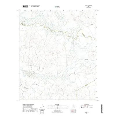
2019 Map of Pluck
USGS Topo · Published 2019About this map
The Neches River meanders through this portion of East Texas, defining the boundary between Angelina and Polk Counties. This bottomland landscape is characterized by complex hydrology, featuring numerous oxbow remnants and secondary channels such as Albritton Slough, Lick Slough, and Deep Slough. The presence of Dollarhide Lake and Dollarhide Cutoff suggests a history of river channel migration and dynamic wetland ecosystems. Away from the river basin, the terrain rises toward Peach Ridge, with small settlements and family landmarks scattered along the local road network.
Find a feature on this map
51 named features on this map. Tap any name to fly to it.
Don’t see what you’re looking for? This feature index may not catch every label — zoom into the map to look around manually.
Map Details
Editions of this 2019 Pluck Map
This is the sole edition of this map. No revisions or reprints were ever made.
Other maps of this area

1927 · Lufkin 4-c
USGS Topo · 1:24,000

1928 · Lufkin 4-d
USGS Topo · 1:24,000

1932 · Manning
USGS Topo · 1:62,500

1953 · Palestine
USGS Topo · 1:250,000

1954 · Beaumont
USGS Topo · 1:250,000

1955 · Camden
USGS Topo · 1:62,500

1955 · New Willard
USGS Topo · 1:62,500

1957 · Beaumont
USGS Topo · 1:250,000

1957 · Palestine
USGS Topo · 1:250,000
1963 · Manning
USGS Topo · 1:24,000