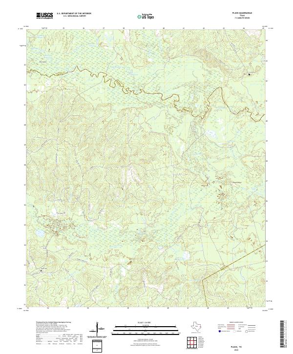
2022 Map of Pluck
USGS Topo · Published 2022About this map
The Neches River forms a serpentine boundary between Angelina and Polk Counties, anchoring a landscape defined by an intricate network of wetlands, sloughs, and creek drainages. This modern survey reveals a low-lying riverine environment where water features like Dollarhide Lake, Lamar Slough, and the isolated The Island dominate the northern terrain. The presence of Albritton Slough and Deep Slough suggests a floodplain that remains dynamic and largely undeveloped, save for scattered timber and rural transit routes.
Find a feature on this map
56 named features on this map. Tap any name to fly to it.
Don’t see what you’re looking for? This feature index may not catch every label — zoom into the map to look around manually.
Map Details
Editions of this 2022 Pluck Map
This is the sole edition of this map. No revisions or reprints were ever made.
Other maps of this area

1927 · Lufkin 4-c
USGS Topo · 1:24,000

1928 · Lufkin 4-d
USGS Topo · 1:24,000

1932 · Manning
USGS Topo · 1:62,500

1953 · Palestine
USGS Topo · 1:250,000

1954 · Beaumont
USGS Topo · 1:250,000

1955 · Camden
USGS Topo · 1:62,500

1955 · New Willard
USGS Topo · 1:62,500

1957 · Beaumont
USGS Topo · 1:250,000

1957 · Palestine
USGS Topo · 1:250,000
1963 · Manning
USGS Topo · 1:24,000