
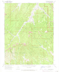
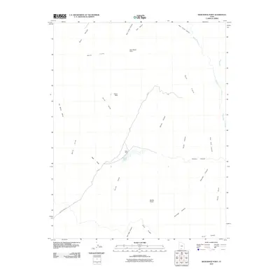
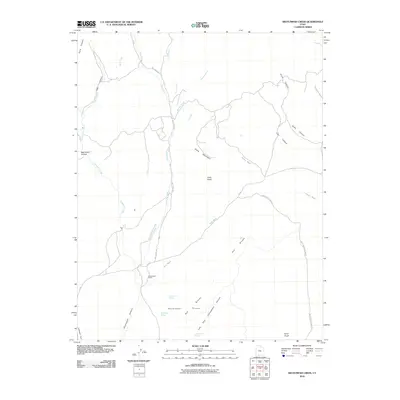
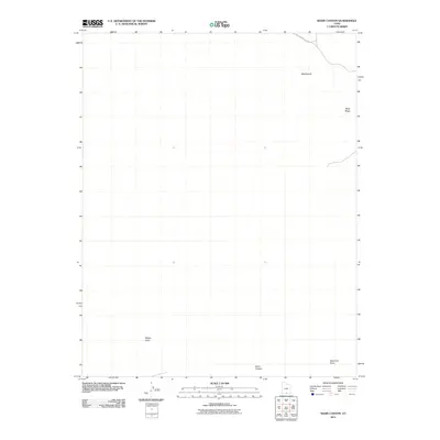
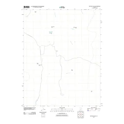
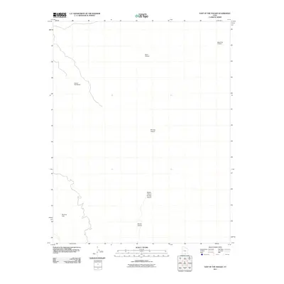
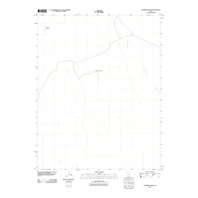
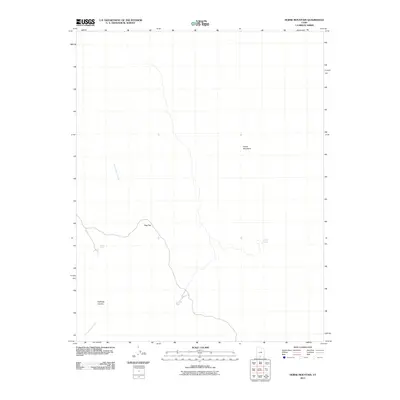
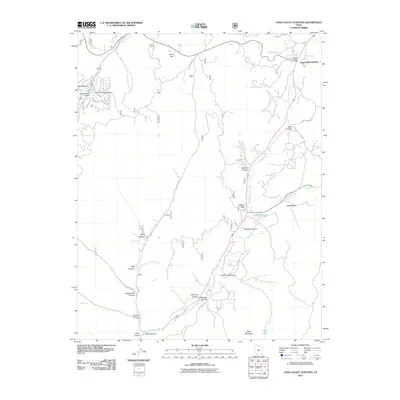
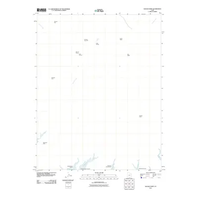
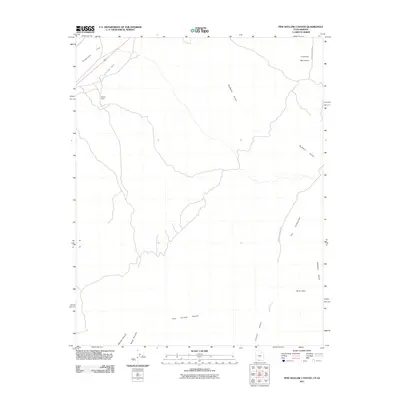
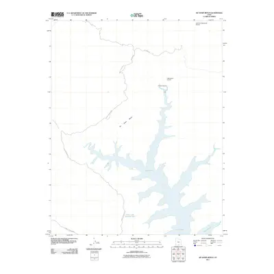
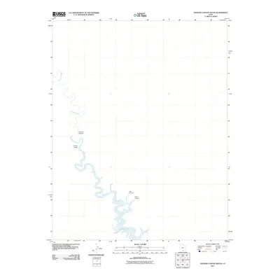
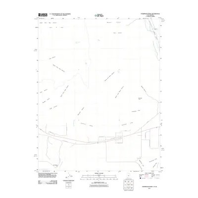
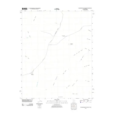
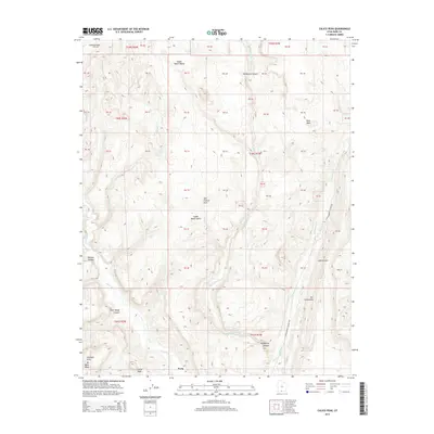
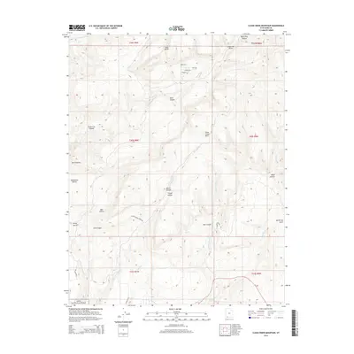
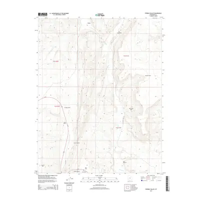
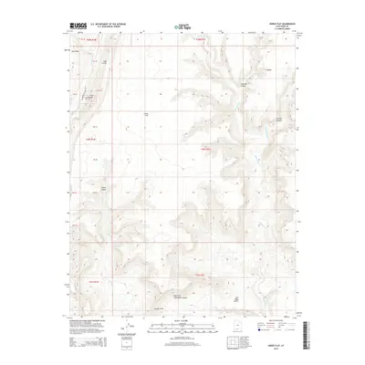
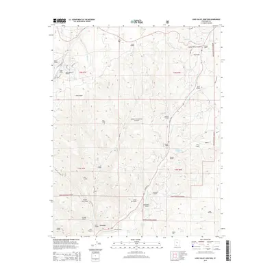
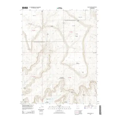
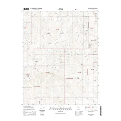
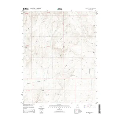
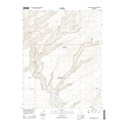
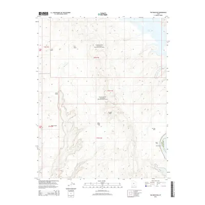
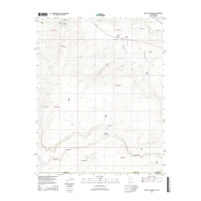
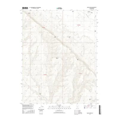
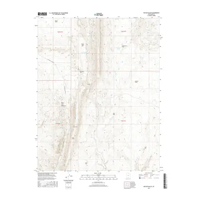
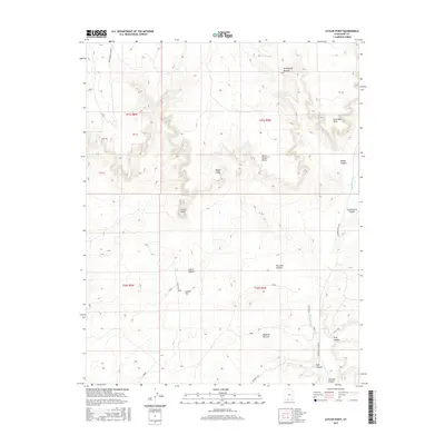
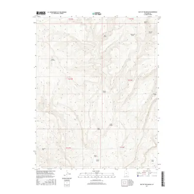
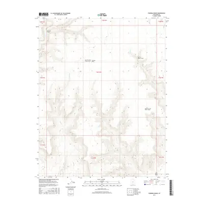
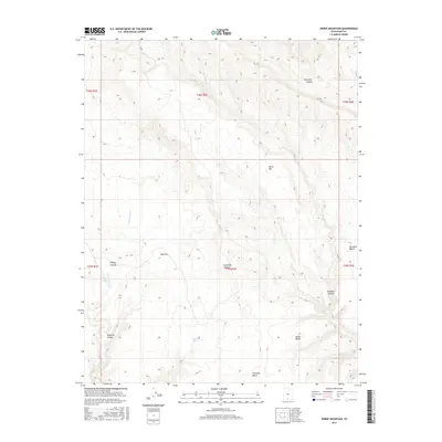
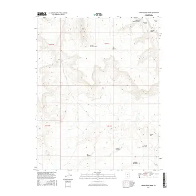
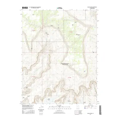
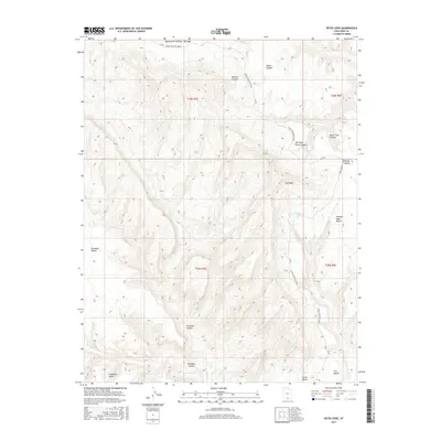
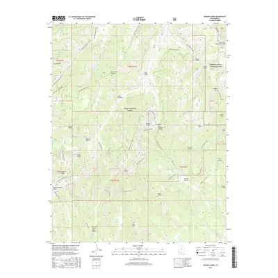
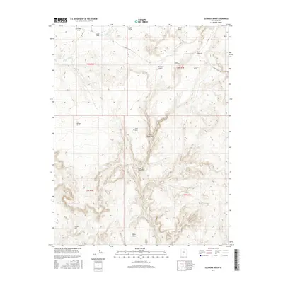
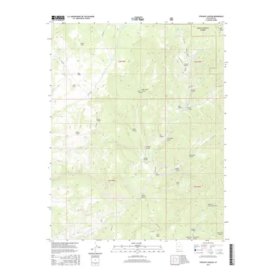
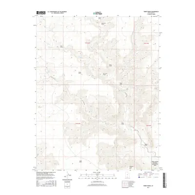
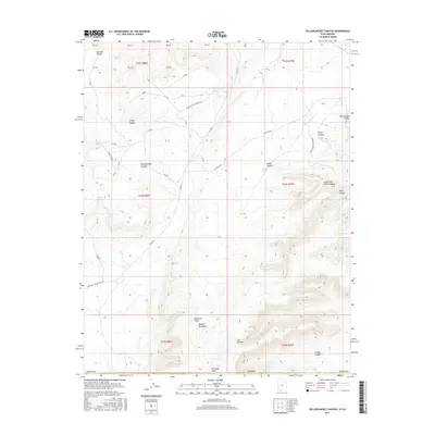
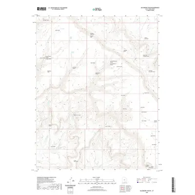
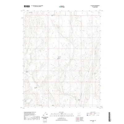
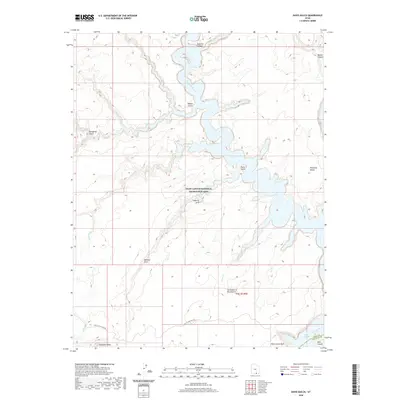
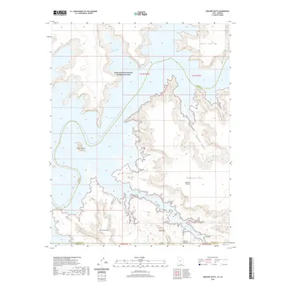
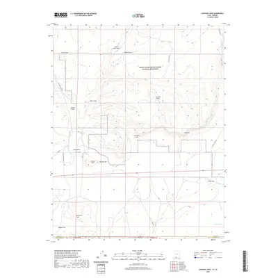
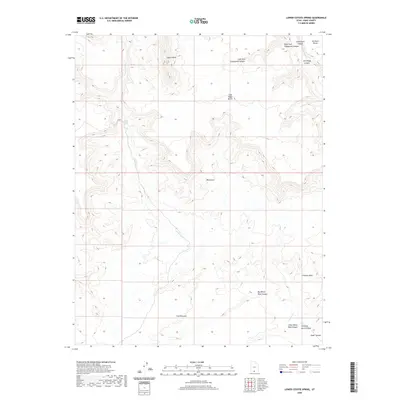
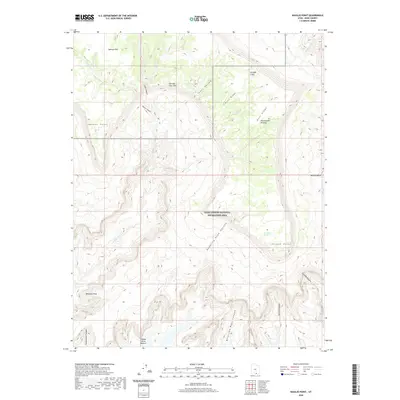
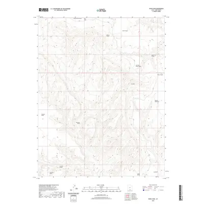
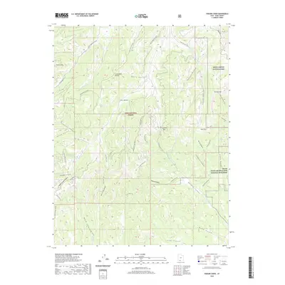
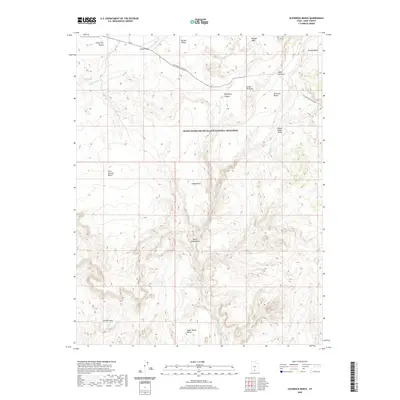
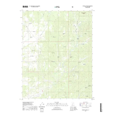
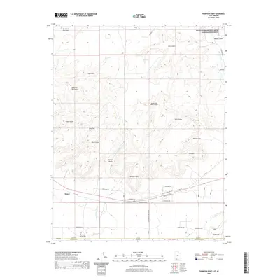
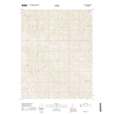
1966 Map of Podunk Creek
USGS Topo · Published 1980About this map
The Paunsaugunt Plateau dominates this high-altitude landscape, where the dramatic descent of the Pink Cliffs creates a labyrinth of deep canyons. In the mid-1960s, this area served as a vital watershed and resource management zone, evidenced by the Podunk Guard Station and the Gaging Station positioned along the East Fork Sevier River. The map details the remote transition between the western edge of Bryce Canyon National Park and the expansive Dixie National Forest, showing a network of primitive transportation routes including numerous Jeep Trails and Pack Trails. Local geography is defined by family-named landmarks and essential water sources like Coyote Spring and Gravel Spring, which supported livestock and forest operations before modern infrastructure reached these high basins. From Sunset Cliffs to the drainage of Kanab Creek, the map preserves the exact layout of the canyons and passes such as Crawford Pass as they were surveyed.
Find a feature on this map
43 named features on this map. Tap any name to fly to it.
Don’t see what you’re looking for? This feature index may not catch every label — zoom into the map to look around manually.
Map Details
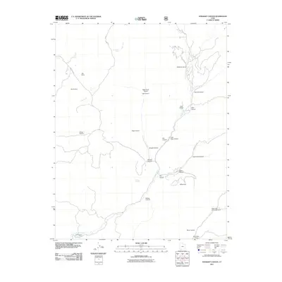
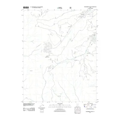
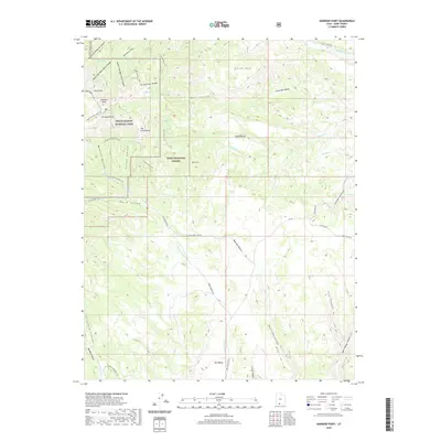
Editions of this 1966 Podunk Creek Map
3 editions found
Historical Maps of Kane County Through Time
384 maps found

1922 Rees Canyon
Kane County, UT

1922 Upper Last Chance
Kane County, UT

1922 Warm Creek
Kane County, UT

1953 Cummings Mesa
Kane County, UT

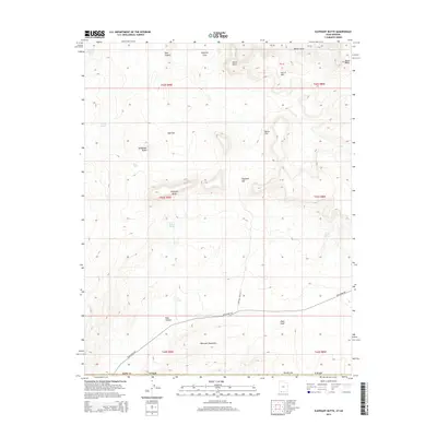
1953 Gunsight Butte
Kane County, UT

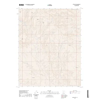
1953 Nipple Butte
Kane County, UT

1953 No Mans Mesa
Kane County, UT

1953 The Rincon
Kane County, UT

1954 Buckskin Gulch NE
Kane County, UT

1954 Buckskin Gulch NW
Kane County, UT

1954 Buckskin Gulch SE
Kane County, UT

1954 Buckskin Gulch SW
Kane County, UT

1954 Johnson
Kane County, UT

1954 Johnson NE
Kane County, UT

1954 Johnson SE
Kane County, UT

1954 Johnson SW
Kane County, UT

1954 Kanab SE
Kane County, UT

1954 Kanab SW
Kane County, UT

1954 Orderville Canyon SE
Kane County, UT

1954 Paria
Kane County, UT

1954 Paria NW
Kane County, UT

1954 Paria SW
Kane County, UT

1954 Telegraph Flat
Kane County, UT

1955 The Cockscob SW
Kane County, UT

1956 Springdale NE
Kane County, UT

1956 Springdale SE
Kane County, UT

1957 Orderville Canyon NE
Kane County, UT

1964 Butler Valley
Kane County, UT

1964 Calico Peak
Kane County, UT

1964 Horse Flat
Kane County, UT

1964 Slickrock Bench
Kane County, UT

1966 Bald Knoll
Kane County, UT

1966 Bull Valley Gorge
Kane County, UT

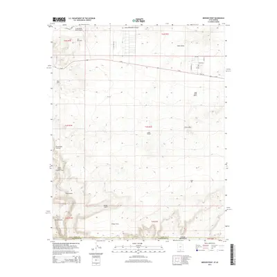
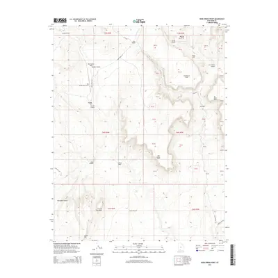
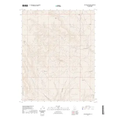
1966 Deer Range Point
Kane County, UT

1966 Deer Spring Point
Kane County, UT

1966 Podunk Creek
Kane County, UT

1966 Rainbow Point
Kane County, UT

1966 Skutumpah Creek
Kane County, UT

1968 Basin Canyon
Kane County, UT

1968 Big Hollow Wash
Kane County, UT

1968 Blackburn Canyon
Kane County, UT

1968 Collet Top
Kane County, UT

1968 East of The Navajo
Kane County, UT

1968 Fourmile Bench
Kane County, UT

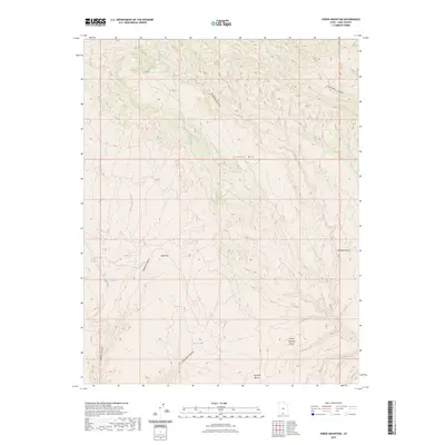
1968 Horse Mtn
Kane County, UT

1968 King Mesa
Kane County, UT

1968 Needle Eye Point
Kane County, UT

1968 Petes Cove
Kane County, UT

1968 Ship Mountain Point
Kane County, UT

1968 Sooner Bench
Kane County, UT

1980 Clear Creek Mountain
Kane County, UT

1980 Elephant Butte
Kane County, UT

1980 Straight Canyon
Kane County, UT

1980 The Barracks
Kane County, UT

1981 Bridger Point
Kane County, UT

1981 Fivemile Valley
Kane County, UT

1981 Glen Canyon City
Kane County, UT

1981 Lone Rock
Kane County, UT

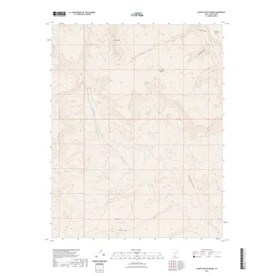
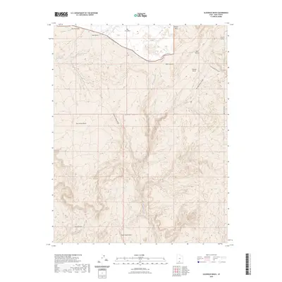
1981 Lower Coyote Spring
Kane County, UT

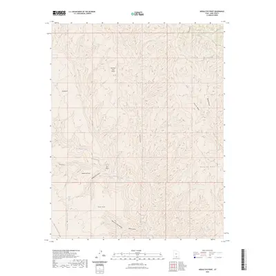
1981 Nipple Butte
Kane County, UT

1981 Tibbet Bench
Kane County, UT

1981 West Clark Bench
Kane County, UT

1985 Gregory Butte
Kane County, UT

1985 Gunsight Butte
Kane County, UT

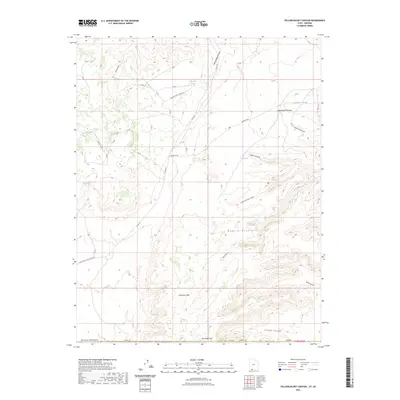
1985 Long Valley Junction
Kane County, UT

1985 Mazuki Point
Kane County, UT

1985 Mount Carmel
Kane County, UT

1985 Navajo Point
Kane County, UT

1985 Sit Down Bench
Kane County, UT

1985 Smoky Hollow
Kane County, UT

1985 Smoky Mountain
Kane County, UT

1985 Strawberry Point
Kane County, UT

1985 Warm Creek Bay
Kane County, UT

1985 White Tower
Kane County, UT

1985 Yellowjacket Canyon
Kane County, UT

1987 Cutler Point
Kane County, UT

1987 Davis Gulch
Kane County, UT

1987 Eightmile Pass
Kane County, UT

1987 Johnson Lakes
Kane County, UT

1987 Nasja Mesa
Kane County, UT

1987 Nephi Point
Kane County, UT

1987 Petrified Hollow
Kane County, UT

1987 Pine Hollow Canyon
Kane County, UT

1987 Pine Point
Kane County, UT

1987 Stevens Canyon South
Kane County, UT

1987 The Rincon NE
Kane County, UT

1987 Thompson Point
Kane County, UT

1997 King Mesa
Kane County, UT

1997 Stevens Canyon South
Kane County, UT

2002 Long Valley Junction
Kane County, UT

2002 Podunk Creek
Kane County, UT

2002 Rainbow Point
Kane County, UT

2002 Straight Canyon
Kane County, UT

2002 Strawberry Point
Kane County, UT
2010 Bull Valley Gorge
Kane County, UT
2010 Clear Creek Mountain
Kane County, UT
2010 Cutler Point
Kane County, UT
2010 Deer Range Point
Kane County, UT

2010 Deer Spring Point
Kane County, UT
2010 Mount Carmel
Kane County, UT
2010 Nephi Point
Kane County, UT
2010 Pine Point
Kane County, UT
2010 Skutumpah Creek
Kane County, UT
2010 The Barracks
Kane County, UT
2010 White Tower
Kane County, UT
2011 Bald Knoll
Kane County, UT
2011 Basin Canyon
Kane County, UT
2011 Big Hollow Wash
Kane County, UT
2011 Blackburn Canyon
Kane County, UT
2011 Bridger Point
Kane County, UT
2011 Butler Valley
Kane County, UT
2011 Calico Peak
Kane County, UT
2011 Collet Top
Kane County, UT
2011 Davis Gulch
Kane County, UT
2011 East of the Navajo
Kane County, UT
2011 Eightmile Pass
Kane County, UT
2011 Elephant Butte
Kane County, UT
2011 Fivemile Valley
Kane County, UT
2011 Fourmile Bench
Kane County, UT
2011 Gregory Butte
Kane County, UT
2011 Gunsight Butte
Kane County, UT
2011 Horse Flat
Kane County, UT
2011 Horse Mountain
Kane County, UT
2011 Johnson Lakes
Kane County, UT
2011 King Mesa
Kane County, UT
2011 Lone Rock
Kane County, UT
2011 Long Valley Junction
Kane County, UT
2011 Lower Coyote Spring
Kane County, UT
2011 Mazuki Point
Kane County, UT
2011 Nasja Mesa
Kane County, UT
2011 Navajo Point
Kane County, UT
2011 Needle Eye Point
Kane County, UT
2011 Nipple Butte
Kane County, UT

2011 Petes Cove
Kane County, UT
2011 Petrified Hollow
Kane County, UT
2011 Pine Hollow Canyon
Kane County, UT
2011 Podunk Creek
Kane County, UT
2011 Rainbow Point
Kane County, UT
2011 Ship Mountain Point
Kane County, UT
2011 Sit Down Bench
Kane County, UT
2011 Slickrock Bench
Kane County, UT
2011 Smoky Hollow
Kane County, UT
2011 Sooner Bench
Kane County, UT
2011 Stevens Canyon South
Kane County, UT
2011 Straight Canyon
Kane County, UT
2011 Strawberry Point
Kane County, UT
2011 The Rincon NE
Kane County, UT
2011 Thompson Point
Kane County, UT
2011 Tibbet Bench
Kane County, UT
2011 Warm Creek Bay
Kane County, UT
2011 West Clark Bench
Kane County, UT
2011 Yellowjacket Canyon
Kane County, UT
2014 Bald Knoll
Kane County, UT

2014 Basin Canyon
Kane County, UT
2014 Big Hollow Wash
Kane County, UT
2014 Blackburn Canyon
Kane County, UT
2014 Bridger Point
Kane County, UT
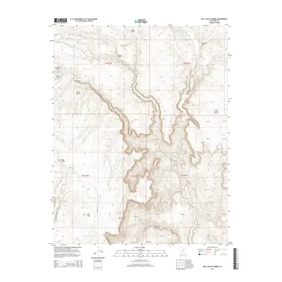
2014 Bull Valley Gorge
Kane County, UT
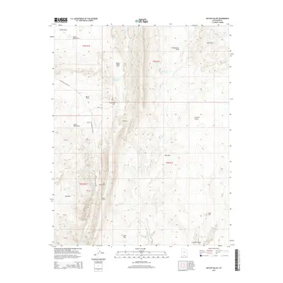
2014 Butler Valley
Kane County, UT
2014 Calico Peak
Kane County, UT
2014 Clear Creek Mountain
Kane County, UT

2014 Collet Top
Kane County, UT
2014 Cutler Point
Kane County, UT
2014 Davis Gulch
Kane County, UT
2014 Deer Range Point
Kane County, UT
2014 Deer Spring Point
Kane County, UT
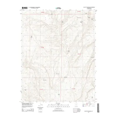
2014 East of the Navajo
Kane County, UT
2014 Eightmile Pass
Kane County, UT
2014 Elephant Butte
Kane County, UT
2014 Fivemile Valley
Kane County, UT
2014 Fourmile Bench
Kane County, UT
2014 Gregory Butte
Kane County, UT
2014 Gunsight Butte
Kane County, UT
2014 Horse Flat
Kane County, UT
2014 Horse Mountain
Kane County, UT
2014 Johnson Lakes
Kane County, UT
2014 King Mesa
Kane County, UT

2014 Lone Rock
Kane County, UT
2014 Long Valley Junction
Kane County, UT
2014 Lower Coyote Spring
Kane County, UT

2014 Mazuki Point
Kane County, UT
2014 Mount Carmel
Kane County, UT
2014 Nasja Mesa
Kane County, UT
2014 Navajo Point
Kane County, UT
2014 Needle Eye Point
Kane County, UT
2014 Nephi Point
Kane County, UT
2014 Nipple Butte
Kane County, UT
2014 Petes Cove
Kane County, UT
2014 Petrified Hollow
Kane County, UT
2014 Pine Hollow Canyon
Kane County, UT
2014 Pine Point
Kane County, UT
2014 Podunk Creek
Kane County, UT
2014 Rainbow Point
Kane County, UT
2014 Ship Mountain Point
Kane County, UT
2014 Sit Down Bench
Kane County, UT
2014 Skutumpah Creek
Kane County, UT
2014 Slickrock Bench
Kane County, UT
2014 Smoky Hollow
Kane County, UT
2014 Sooner Bench
Kane County, UT
2014 Stevens Canyon South
Kane County, UT
2014 Straight Canyon
Kane County, UT
2014 Strawberry Point
Kane County, UT
2014 The Barracks
Kane County, UT
2014 The Rincon NE
Kane County, UT
2014 Thompson Point
Kane County, UT
2014 Tibbet Bench
Kane County, UT
2014 Warm Creek Bay
Kane County, UT
2014 West Clark Bench
Kane County, UT
2014 White Tower
Kane County, UT
2014 Yellowjacket Canyon
Kane County, UT
2017 Bald Knoll
Kane County, UT
2017 Basin Canyon
Kane County, UT
2017 Big Hollow Wash
Kane County, UT
2017 Blackburn Canyon
Kane County, UT

2017 Bridger Point
Kane County, UT
2017 Bull Valley Gorge
Kane County, UT
2017 Butler Valley
Kane County, UT
2017 Calico Peak
Kane County, UT
2017 Clear Creek Mountain
Kane County, UT
2017 Collet Top
Kane County, UT
2017 Cutler Point
Kane County, UT
2017 Davis Gulch
Kane County, UT
2017 Deer Range Point
Kane County, UT
2017 Deer Spring Point
Kane County, UT
2017 East of the Navajo
Kane County, UT
2017 Eightmile Pass
Kane County, UT
2017 Elephant Butte
Kane County, UT
2017 Fivemile Valley
Kane County, UT
2017 Fourmile Bench
Kane County, UT
2017 Gregory Butte
Kane County, UT
2017 Gunsight Butte
Kane County, UT
2017 Horse Flat
Kane County, UT
2017 Horse Mountain
Kane County, UT
2017 Johnson Lakes
Kane County, UT

2017 King Mesa
Kane County, UT
2017 Lone Rock
Kane County, UT
2017 Long Valley Junction
Kane County, UT
2017 Lower Coyote Spring
Kane County, UT
2017 Mazuki Point
Kane County, UT
2017 Mount Carmel
Kane County, UT
2017 Nasja Mesa
Kane County, UT
2017 Navajo Point
Kane County, UT
2017 Needle Eye Point
Kane County, UT
2017 Nephi Point
Kane County, UT
2017 Nipple Butte
Kane County, UT
2017 Petes Cove
Kane County, UT
2017 Petrified Hollow
Kane County, UT
2017 Pine Hollow Canyon
Kane County, UT
2017 Pine Point
Kane County, UT
2017 Podunk Creek
Kane County, UT
2017 Rainbow Point
Kane County, UT

2017 Ship Mountain Point
Kane County, UT
2017 Sit Down Bench
Kane County, UT
2017 Skutumpah Creek
Kane County, UT
2017 Slickrock Bench
Kane County, UT
2017 Smoky Hollow
Kane County, UT
2017 Sooner Bench
Kane County, UT
2017 Stevens Canyon South
Kane County, UT
2017 Straight Canyon
Kane County, UT
2017 Strawberry Point
Kane County, UT
2017 The Barracks
Kane County, UT
2017 The Rincon NE
Kane County, UT

2017 Thompson Point
Kane County, UT
2017 Tibbet Bench
Kane County, UT
2017 Warm Creek Bay
Kane County, UT
2017 West Clark Bench
Kane County, UT
2017 White Tower
Kane County, UT
2017 Yellowjacket Canyon
Kane County, UT
2020 Bald Knoll
Kane County, UT
2020 Basin Canyon
Kane County, UT
2020 Big Hollow Wash
Kane County, UT
2020 Blackburn Canyon
Kane County, UT
2020 Bridger Point
Kane County, UT
2020 Bull Valley Gorge
Kane County, UT
2020 Butler Valley
Kane County, UT
2020 Calico Peak
Kane County, UT
2020 Clear Creek Mountain
Kane County, UT
2020 Collet Top
Kane County, UT
2020 Cutler Point
Kane County, UT
2020 Davis Gulch
Kane County, UT
2020 Deer Range Point
Kane County, UT
2020 Deer Spring Point
Kane County, UT
2020 East of the Navajo
Kane County, UT
2020 Eightmile Pass
Kane County, UT
2020 Elephant Butte
Kane County, UT
2020 Fivemile Valley
Kane County, UT
2020 Fourmile Bench
Kane County, UT
2020 Gregory Butte
Kane County, UT
2020 Gunsight Butte
Kane County, UT
2020 Horse Flat
Kane County, UT
2020 Horse Mountain
Kane County, UT
2020 Johnson Lakes
Kane County, UT
2020 King Mesa
Kane County, UT
2020 Lone Rock
Kane County, UT
2020 Long Valley Junction
Kane County, UT
2020 Lower Coyote Spring
Kane County, UT
2020 Mazuki Point
Kane County, UT
2020 Mount Carmel
Kane County, UT
2020 Nasja Mesa
Kane County, UT
2020 Navajo Point
Kane County, UT
2020 Needle Eye Point
Kane County, UT
2020 Nephi Point
Kane County, UT
2020 Nipple Butte
Kane County, UT
2020 Petes Cove
Kane County, UT
2020 Petrified Hollow
Kane County, UT
2020 Pine Hollow Canyon
Kane County, UT
2020 Pine Point
Kane County, UT
2020 Podunk Creek
Kane County, UT
2020 Rainbow Point
Kane County, UT
2020 Ship Mountain Point
Kane County, UT

2020 Sit Down Bench
Kane County, UT
2020 Skutumpah Creek
Kane County, UT
2020 Slickrock Bench
Kane County, UT
2020 Smoky Hollow
Kane County, UT
2020 Sooner Bench
Kane County, UT
2020 Stevens Canyon South
Kane County, UT
2020 Straight Canyon
Kane County, UT
2020 Strawberry Point
Kane County, UT
2020 The Barracks
Kane County, UT
2020 The Rincon NE
Kane County, UT
2020 Thompson Point
Kane County, UT
2020 Tibbet Bench
Kane County, UT
2020 Warm Creek Bay
Kane County, UT
2020 West Clark Bench
Kane County, UT
2020 White Tower
Kane County, UT
2020 Yellowjacket Canyon
Kane County, UT

2023 Bald Knoll
Kane County, UT

2023 Basin Canyon
Kane County, UT

2023 Big Hollow Wash
Kane County, UT

2023 Blackburn Canyon
Kane County, UT
2023 Bridger Point
Kane County, UT

2023 Bull Valley Gorge
Kane County, UT
2023 Butler Valley
Kane County, UT

2023 Calico Peak
Kane County, UT

2023 Clear Creek Mountain
Kane County, UT
2023 Collet Top
Kane County, UT

2023 Cutler Point
Kane County, UT

2023 Davis Gulch
Kane County, UT

2023 Deer Range Point
Kane County, UT

2023 Deer Spring Point
Kane County, UT
2023 East of the Navajo
Kane County, UT

2023 Eightmile Pass
Kane County, UT

2023 Elephant Butte
Kane County, UT

2023 Fivemile Valley
Kane County, UT
2023 Fourmile Bench
Kane County, UT

2023 Gregory Butte
Kane County, UT

2023 Gunsight Butte
Kane County, UT
2023 Horse Flat
Kane County, UT
2023 Horse Mountain
Kane County, UT

2023 Johnson Lakes
Kane County, UT

2023 King Mesa
Kane County, UT

2023 Lone Rock
Kane County, UT

2023 Long Valley Junction
Kane County, UT
2023 Lower Coyote Spring
Kane County, UT

2023 Mazuki Point
Kane County, UT

2023 Mount Carmel
Kane County, UT

2023 Nasja Mesa
Kane County, UT

2023 Navajo Point
Kane County, UT
2023 Needle Eye Point
Kane County, UT

2023 Nephi Point
Kane County, UT
2023 Nipple Butte
Kane County, UT

2023 Petes Cove
Kane County, UT

2023 Petrified Hollow
Kane County, UT

2023 Pine Hollow Canyon
Kane County, UT

2023 Pine Point
Kane County, UT

2023 Podunk Creek
Kane County, UT

2023 Rainbow Point
Kane County, UT
2023 Ship Mountain Point
Kane County, UT

2023 Sit Down Bench
Kane County, UT

2023 Skutumpah Creek
Kane County, UT
2023 Slickrock Bench
Kane County, UT

2023 Smoky Hollow
Kane County, UT

2023 Sooner Bench
Kane County, UT

2023 Stevens Canyon South
Kane County, UT

2023 Straight Canyon
Kane County, UT

2023 Strawberry Point
Kane County, UT

2023 The Barracks
Kane County, UT

2023 The Rincon NE
Kane County, UT

2023 Thompson Point
Kane County, UT

2023 Tibbet Bench
Kane County, UT

2023 Warm Creek Bay
Kane County, UT

2023 West Clark Bench
Kane County, UT

2023 White Tower
Kane County, UT
2023 Yellowjacket Canyon
Kane County, UT