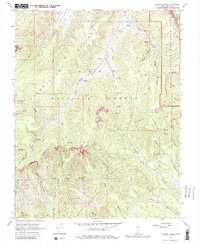
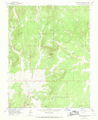
1966 Map of Podunk Creek
USGS Topo · Published 1980About this map
The Paunsaugunt Plateau and the dramatic drop of the Pink Cliffs dominate this mid-century landscape in the high desert of Southern Utah. This survey documents a critical transition zone where the high plateau gives way to deep drainages like Podunk Creek and Robinson Canyon. Within Dixie National Forest, the Podunk Guard Station serves as a remote outpost for land management, while a Gaging Station on the Sieler Meadow Fork monitors the scarce water resources of the region. The map shows a network of livestock and timber access routes, including a Pipeline through the canyons and numerous trails used by ranchers and early forest rangers. The eastern boundary of the sheet preserves the early wilderness character of Bryce Canyon National Park near Yovimpa Pass, capturing a period before modern recreational infrastructure fully transformed the more secluded reaches of the plateau.
Find a feature on this map
47 named features on this map. Tap any name to fly to it.
Don’t see what you’re looking for? This feature index may not catch every label — zoom into the map to look around manually.
Map Details
Editions of this 1966 Podunk Creek Map
3 editions found
Other maps of this area

1886 · Kanab
USGS Topo · 1:250,000

1953 · Cedar City
USGS Topo · 1:250,000

1958 · Cedar City
USGS Topo · 1:250,000

1962 · Cedar City
USGS Topo · 1:250,000

1966 · Alton
USGS Topo · 1:24,000

1966 · Bald Knoll
USGS Topo · 1:24,000
1966 · Deer Spring Point
USGS Topo · 1:24,000

1966 · George Mtn
USGS Topo · 1:24,000
1966 · Podunk Creek
USGS Topo · 1:24,000
1966 · Skutumpah Creek
USGS Topo · 1:24,000